MyTopo
Whitworth Ranch Texas US Topo Map
Couldn't load pickup availability
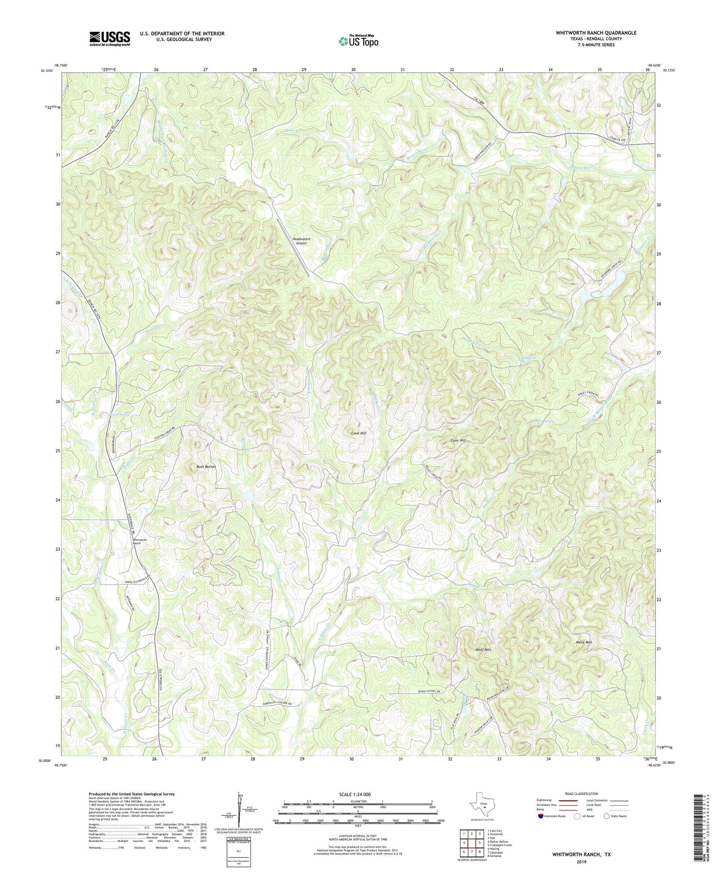
2022 topographic map quadrangle Whitworth Ranch in the state of Texas. Scale: 1:24000. Based on the newly updated USGS 7.5' US Topo map series, this map is in the following counties: Kendall. The map contains contour data, water features, and other items you are used to seeing on USGS maps, but also has updated roads and other features. This is the next generation of topographic maps. Printed on high-quality waterproof paper with UV fade-resistant inks.
Quads adjacent to this one:
West: Rafter Hollow
Northwest: Cain City
North: Stonewall
Northeast: Hye
East: Crabapple Creek
Southeast: Kendalia
South: Sisterdale
Southwest: Waring
This map covers the same area as the classic USGS quad with code o30098a6.
Contains the following named places: Askey Creek, Blackberry Creek, Bust Buttes, Carson Spring, Cave Hill, Comfort Division, Comfort Historical Society, Cothrum Ranch, Delaware Spring, Diamond K Ranch Airport, Haag Creek, Haag Ranch, Headwaters Airport, Jung Creek, Lindendale, Lone Hill, Meier Creek, Meta Mountain, Offer Ranch, Platte Creek, Reeh Creek, Sisterdale Valley District, Soell Creek, Wenzel Creek, Wenzel Spring, Whitworth Ranch, Willie Creek, Wolf Mountain