MyTopo
Wayland Texas US Topo Map
Couldn't load pickup availability
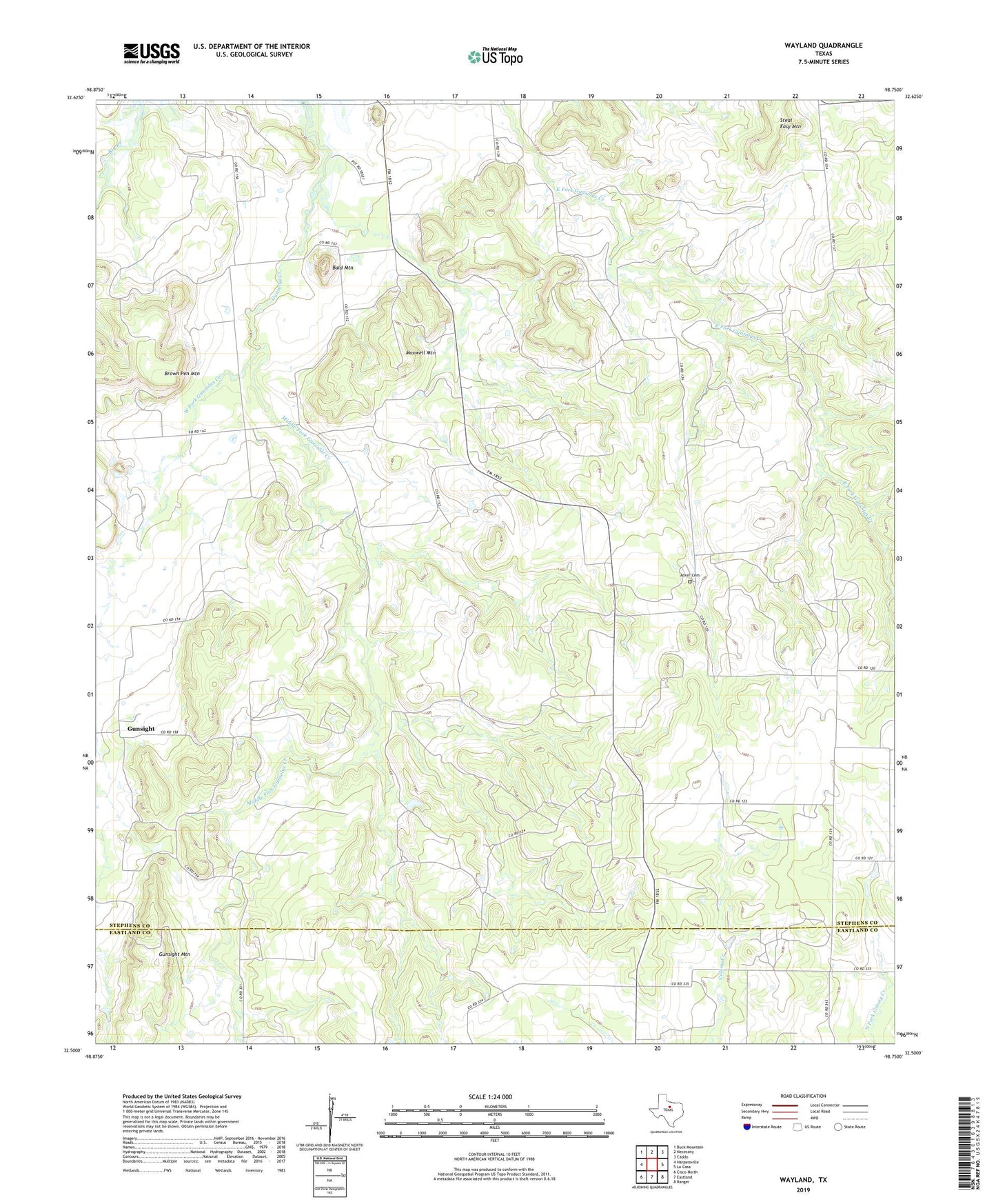
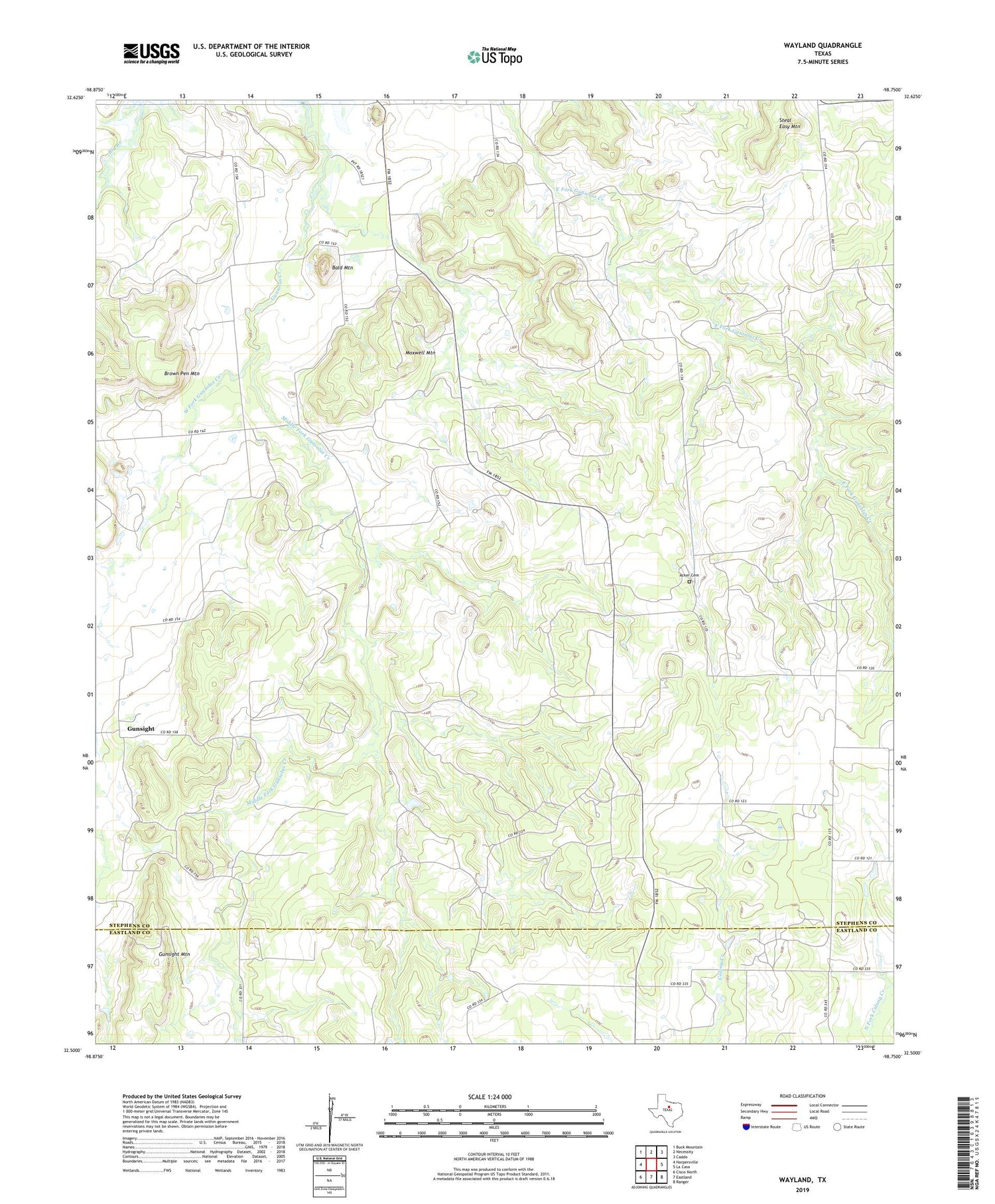
2019 topographic map quadrangle Wayland in the state of Texas. Scale: 1:24000. Based on the newly updated USGS 7.5' US Topo map series, this map is in the following counties: Stephens, Eastland. The map contains contour data, water features, and other items you are used to seeing on USGS maps, but also has updated roads and other features. This is the next generation of topographic maps. Printed on high-quality waterproof paper with UV fade-resistant inks.
Quads adjacent to this one:
West: Harpersville
Northwest: Buck Mountain
North: Necessity
Northeast: Caddo
East: La Casa
Southeast: Ranger
South: Eastland
Southwest: Cisco North
Contains the following named places: Acker Cemetery, Bald Mountain, Big Branch, Brown Pen Mountain, Community Building, Gibon Lake Dam, Gibson Lake, Gunsight, Gunsight Mountain, Maxwell Mountain, Middle Fork Gunsolus Creek, Steal Easy Mountain, Wayland, West Fork Gunsolus Creek