MyTopo
Wells SW Texas US Topo Map
Couldn't load pickup availability
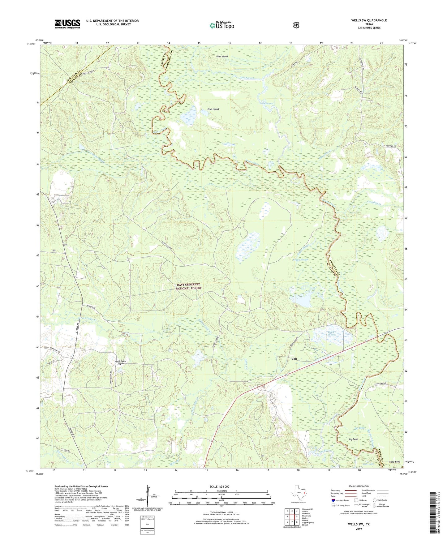
2019 topographic map quadrangle Wells SW in the state of Texas. Scale: 1:24000. Based on the newly updated USGS 7.5' US Topo map series, this map is in the following counties: Trinity, Angelina, Houston. The map contains contour data, water features, and other items you are used to seeing on USGS maps, but also has updated roads and other features. This is the next generation of topographic maps. Printed on high-quality waterproof paper with UV fade-resistant inks.
Quads adjacent to this one:
West: Centralia
Northwest: Kennard NE
North: Wells
Northeast: Clawson
East: Keltys
Southeast: Diboll
South: Apple Springs
Southwest: Crecy
Contains the following named places: Angelina Club, Angelina CLub, Big Bend, Big Bend Slough, Black Cat Lake, Boggy Slough, Boggy Slough Club, Bristow Creek, Buncombe Creek, Cedar Creek, Cochino Bayou, Cole Lake, Crawford Creek, Durham Creek, Eason Lake Club, Eason Lake CLub, Neches Club, New Church, New CHurch, North Cedar Airport, North Fork Cedar Creek, Old Channel, Old River, Pine Island, Pine Island Club, Pine Ridge Club, Raville Siding, Rowan Creek, South Fork Cedar Creek, Vair, White Branch