MyTopo
Keltys Texas US Topo Map
Couldn't load pickup availability
Also explore the Keltys Forest Service Topo of this same quad for updated USFS data
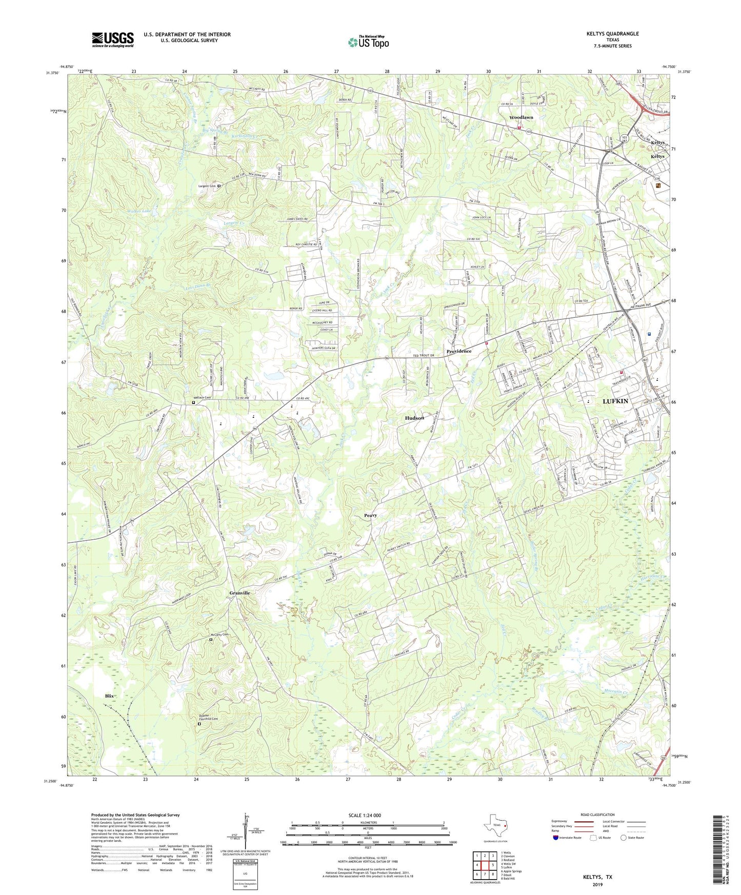
2022 topographic map quadrangle Keltys in the state of Texas. Scale: 1:24000. Based on the newly updated USGS 7.5' US Topo map series, this map is in the following counties: Angelina, Trinity. The map contains contour data, water features, and other items you are used to seeing on USGS maps, but also has updated roads and other features. This is the next generation of topographic maps. Printed on high-quality waterproof paper with UV fade-resistant inks.
Quads adjacent to this one:
West: Wells SW
Northwest: Wells
North: Clawson
Northeast: Redland
East: Lufkin
Southeast: Bald Hill
South: Diboll
Southwest: Apple Springs
This map covers the same area as the classic USGS quad with code o31094c7.
Contains the following named places: Angelina County Constable Precinct Two, Bethlehem Church, Big Spring Branch, Blackburn Lake, Blackburn Lake Dam, Blix, Boiler Spring Branch, Bradley Branch, Brookhollow Elementary School, City of Hudson, Clark-Whitton House, Conner Spring Branch, Crossroad Church, Dubose - Fairchild Cemetery, Granville, Happy Hour Church, Hudson, Hudson City Hall, Hudson School, Hudson Volunteer Fire Department Station 1, Hudson Volunteer Fire Department Station 2, KBLZ-AM (Lufkin), Keltys, Keltys Worker Housing, KTRE Radio Tower (Huntsville), Kurkindoll Creek, Kurth-Glover House, Largent Cemetery, Largent Creek, Levi Dunn Branch, Little Dunn Church, Lufkin Fire Department Station 4, Lufkin Post Office, Mabel Melear School, McCarty Cemetery, Moccasin Creek, Morris Franks Park, New Hope Church, Old Union Church, Peavy, Providence, Stubblefield Learning Center, Walker Lake, Wallace Cemetery, Woodland Heights Medical Center, Woodlawn, Zed Creek, ZIP Code: 75904