MyTopo
Clawson Texas US Topo Map
Couldn't load pickup availability
Also explore the Clawson Forest Service Topo of this same quad for updated USFS data
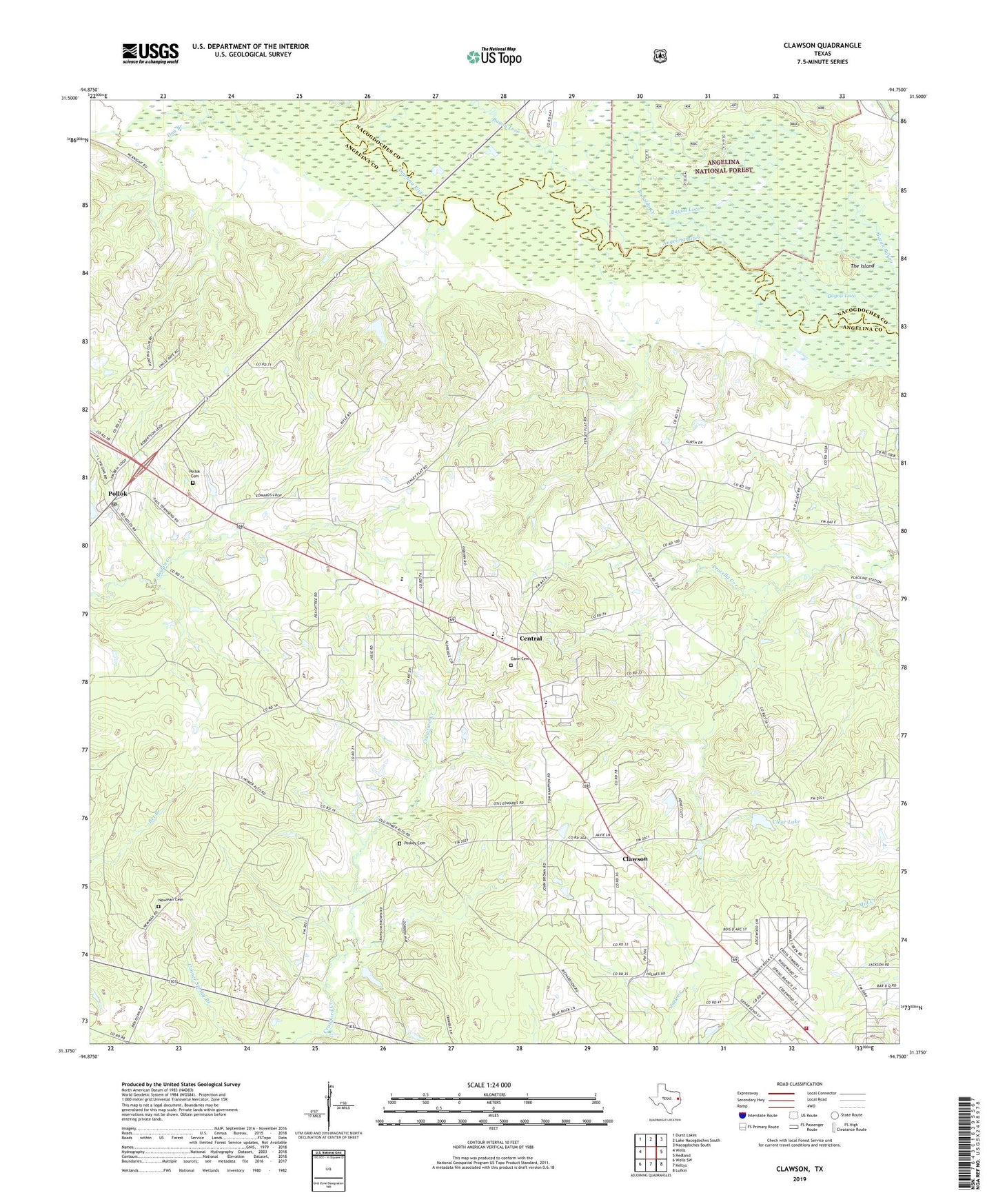
2022 topographic map quadrangle Clawson in the state of Texas. Scale: 1:24000. Based on the newly updated USGS 7.5' US Topo map series, this map is in the following counties: Angelina, Nacogdoches. The map contains contour data, water features, and other items you are used to seeing on USGS maps, but also has updated roads and other features. This is the next generation of topographic maps. Printed on high-quality waterproof paper with UV fade-resistant inks.
Quads adjacent to this one:
West: Wells
Northwest: Durst Lakes
North: Lake Nacogdoches South
Northeast: Nacogdoches South
East: Redland
Southeast: Lufkin
South: Keltys
Southwest: Wells SW
This map covers the same area as the classic USGS quad with code o31094d7.
Contains the following named places: Alazan Bayou, Alazan Bayou Wildlife Management Area, Bayou Loco, Bonaldo Creek, Central, Central Fire Department Station 2, Clawson, Clear Lake, Clear Lake Dam, Durant, Gann Cemetery, KAFX-FM (Diboll), KLDN-FM (Lufkin), KLSB-TV (Nacogdoches), KSWP-FM (Lufkin), KTRE-TV (Lufkin), KUEZ-FM (Lufkin), KWXL-AM (Hudson), KYKS-FM (Lufkin), Lufkin Air Force Station, Newman Cemetery, Pollok, Pollok Cemetery, Pollok Division, Pollok Post Office, Pollok School, Poskey Cemetery, The Island