MyTopo
Winters Texas US Topo Map
Couldn't load pickup availability
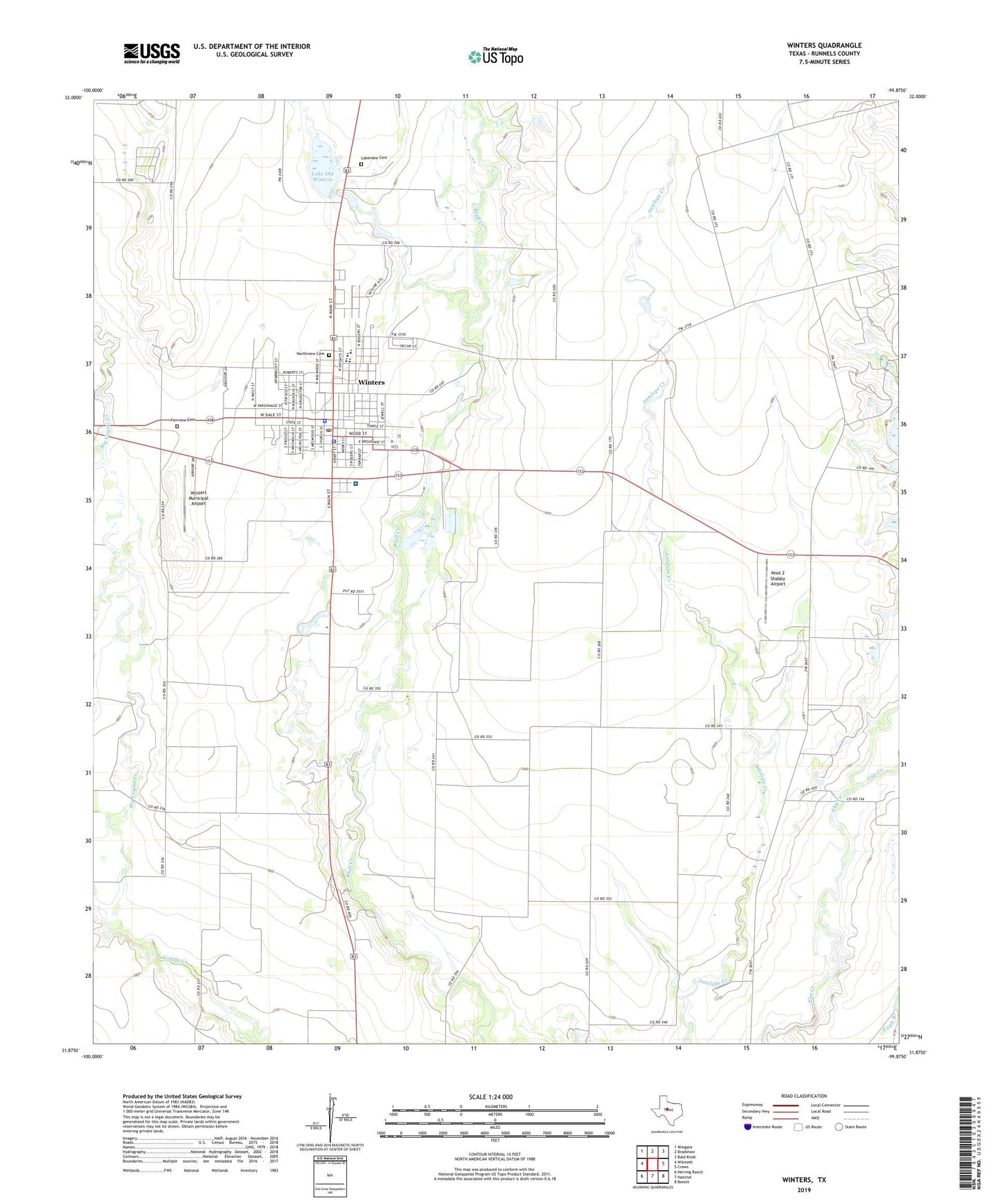
2022 topographic map quadrangle Winters in the state of Texas. Scale: 1:24000. Based on the newly updated USGS 7.5' US Topo map series, this map is in the following counties: Runnels. The map contains contour data, water features, and other items you are used to seeing on USGS maps, but also has updated roads and other features. This is the next generation of topographic maps. Printed on high-quality waterproof paper with UV fade-resistant inks.
Quads adjacent to this one:
West: Wilmeth
Northwest: Wingate
North: Bradshaw
Northeast: Bald Knob
East: Crews
Southeast: Benoit
South: Hatchel
Southwest: Herring Ranch
This map covers the same area as the classic USGS quad with code o31099h8.
Contains the following named places: Big Coyote Creek, Catholic Church Hall, Church of Christ, City of Winters, Fairview Cemetery, Gap Creek, Knot 2 Shabby Airport, Lake Old Winters, Lakeview Cemetery, Little Coyote Creek, Lutheran Church, North Runnels Hospital, Northview Cemetery, Old Lake Winters Dam, Runnels County Constable's Office Precinct 2, Runnels County Sheriff Department, Winters, Winters City Hall, Winters Country Club, Winters Division, Winters Elementary School, Winters Junior and Senior High School, Winters Municipal Airport, Winters Police Department, Winters Post Office, Z I Hale Museum, ZIP Code: 79567