MyTopo
Wyser Bottom Texas US Topo Map
Couldn't load pickup availability
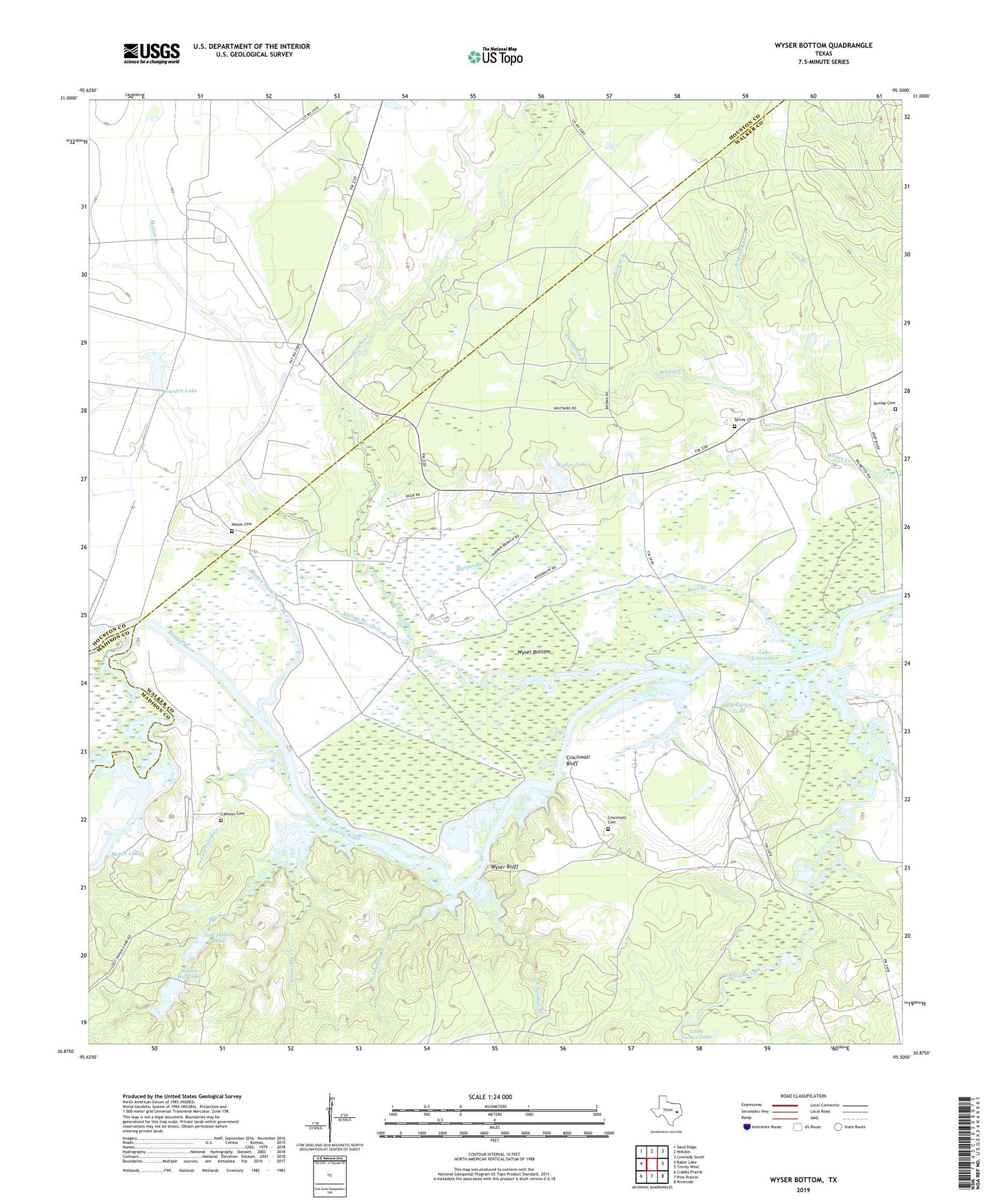
2019 topographic map quadrangle Wyser Bottom in the state of Texas. Scale: 1:24000. Based on the newly updated USGS 7.5' US Topo map series, this map is in the following counties: Walker, Houston, Madison. The map contains contour data, water features, and other items you are used to seeing on USGS maps, but also has updated roads and other features. This is the next generation of topographic maps. Printed on high-quality waterproof paper with UV fade-resistant inks.
Quads adjacent to this one:
West: Baker Lake
Northwest: Sand Ridge
North: Weldon
Northeast: Lovelady South
East: Trinity West
Southeast: Riverside
South: Pine Prairie
Southwest: Crabbs Prairie
Contains the following named places: Bear Branch, Bedias Creek, Big Tucker Lake, Black Creek, Calhoun Cemetery, Calhoun Ferry, Cincinnati Bluff, Cincinnati Cemetery, Dunlap Cemetery, East Sulphur Branch, Eve Branch, Garden Lake, Garden Lake Dam, Graveyard Creek, Green Pond, Harper Branch, Horseshoe Lake, Indian Hill Lake, Indian Hill Lake Dam, Jenkins Branch, Little Tucker Lake, Lost Indian Camp, Lost Indian Lake, Lost Indian Lake Dam, Mason Cemetery, Mason Slough, Melton Branch, Moten Lake, Moten Lake Dam, Nelson Creek, New Hope Church, Old Plantation Cemetery, Polecat Branch, Rocky Ford Church, Spivey Cemetery, Thompson Branch, Waller Lake, West Sulphur Branch, White Oak Creek, Woods Slough, Wright Creek, Wyser Bluff, Wyser Bottom