MyTopo
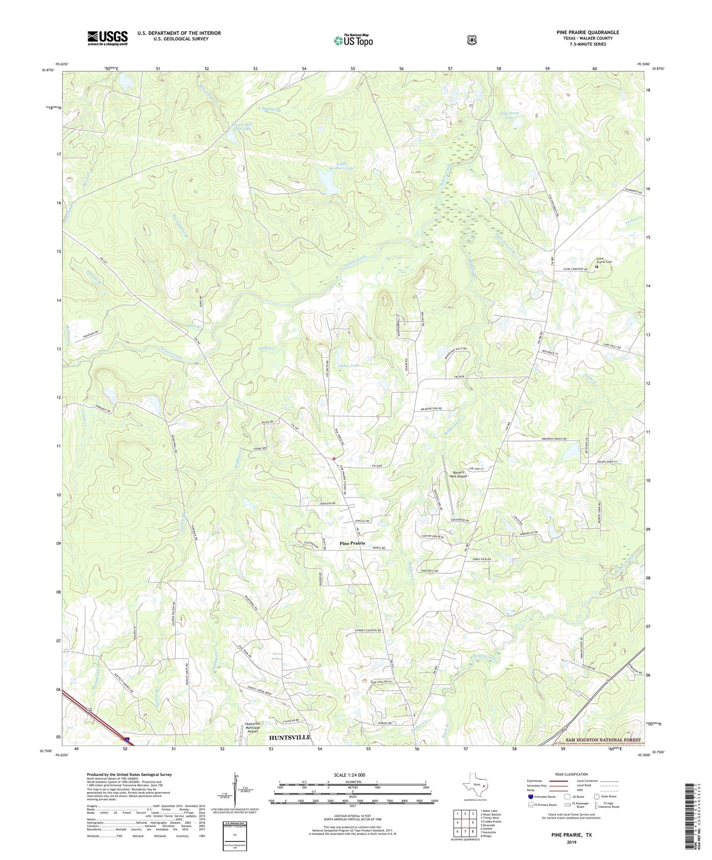
Pine Prairie Texas US Topo Map
Couldn't load pickup availability
Also explore the Pine Prairie Forest Service Topo of this same quad for updated USFS data
2022 topographic map quadrangle Pine Prairie in the state of Texas. Scale: 1:24000. Based on the newly updated USGS 7.5' US Topo map series, this map is in the following counties: Walker. The map contains contour data, water features, and other items you are used to seeing on USGS maps, but also has updated roads and other features. This is the next generation of topographic maps. Printed on high-quality waterproof paper with UV fade-resistant inks.
Quads adjacent to this one:
West: Crabbs Prairie
Northwest: Baker Lake
North: Wyser Bottom
Northeast: Trinity West
East: Riverside
Southeast: Phelps
South: Huntsville
Southwest: Galilee
This map covers the same area as the classic USGS quad with code o30095g5.
Contains the following named places: Baldwin Creek, Big Sulphur Branch, Cline Prairie Cemetery, Crabb Creek, Easam Mill Seat Lake, Easam Mill Seat Lake Dam, Flag Point Lake, Gibbs Brothers Lake, Gibbs Brothers Lake Dam, Hadley Creek, Harmony Grove Church, Little School Branch, Pine Prairie, Pine Prairie Church, Pine Prairie School, Pine Prairie Volunteer Fire Department, Possum Branch, Post Oak Branch, Raven's Nest Airport, Rosenwall School, Saint Marks Church, Saint Paul Church, Sixmile Branch, Sudan Lake, Thompson Creek, Town Branch, Wolf Branch, ZIP Code: 77320