MyTopo
Short Canyon Utah US Topo Map
Couldn't load pickup availability
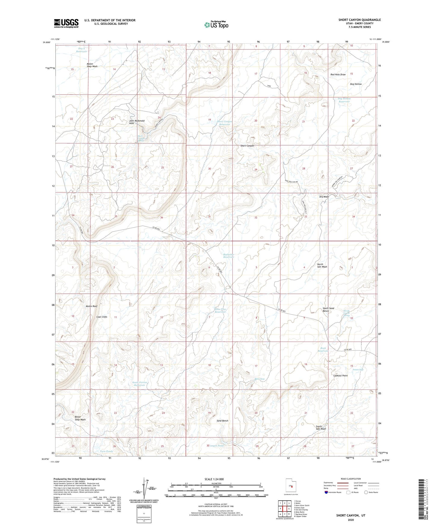
2023 topographic map quadrangle Short Canyon in the state of Utah. Scale: 1:24000. Based on the newly updated USGS 7.5' US Topo map series, this map is in the following counties: Emery. The map contains contour data, water features, and other items you are used to seeing on USGS maps, but also has updated roads and other features. This is the next generation of topographic maps. Printed on high-quality waterproof paper with UV fade-resistant inks.
Quads adjacent to this one:
West: Emery East
Northwest: Ferron
North: Molen
Northeast: Horn Silver Gulch
East: Sid And Charley
Southeast: Copper Globe
South: Big Bend Draw
Southwest: Mesa Butte
This map covers the same area as the classic USGS quad with code o38111h1.
Contains the following named places: Bitter Seep, Canyon Pond, Dog Hollow, Dog Hollow Reservoir, Dry Wash, Dry X Reservoir, Hiram Corral Spring, Jensen Seep, John McDonald Hole, Lone Tree Reservoir, Lookout Point, Molen Reef, Molen Seep Wash, Rochester Reservoir, Rock Reservoir, Sand Bench Reservoir, Short Canyon, Short Canyon Reservoir, Short Canyon Spring, South Ferron Reservoir, South Sand Bench, Twin Ponds