MyTopo
Sid And Charley Utah US Topo Map
Couldn't load pickup availability
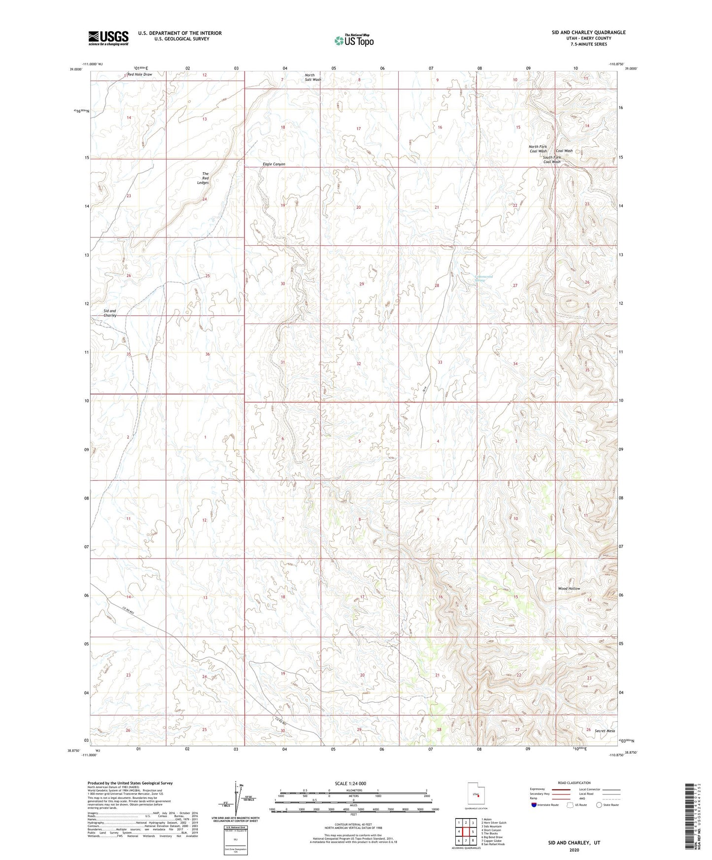
2023 topographic map quadrangle Sid And Charley in the state of Utah. Scale: 1:24000. Based on the newly updated USGS 7.5' US Topo map series, this map is in the following counties: Emery. The map contains contour data, water features, and other items you are used to seeing on USGS maps, but also has updated roads and other features. This is the next generation of topographic maps. Printed on high-quality waterproof paper with UV fade-resistant inks.
Quads adjacent to this one:
West: Short Canyon
Northwest: Molen
North: Horn Silver Gulch
Northeast: Sids Mountain
East: The Blocks
Southeast: San Rafael Knob
South: Copper Globe
Southwest: Big Bend Draw
This map covers the same area as the classic USGS quad with code o38110h8.
Contains the following named places: Cottonwood Spring, Eagle Canyon, North Fork Coal Wash, Sid and Charley, South Fork Coal Wash