MyTopo
Big Hollow Utah US Topo Map
Couldn't load pickup availability
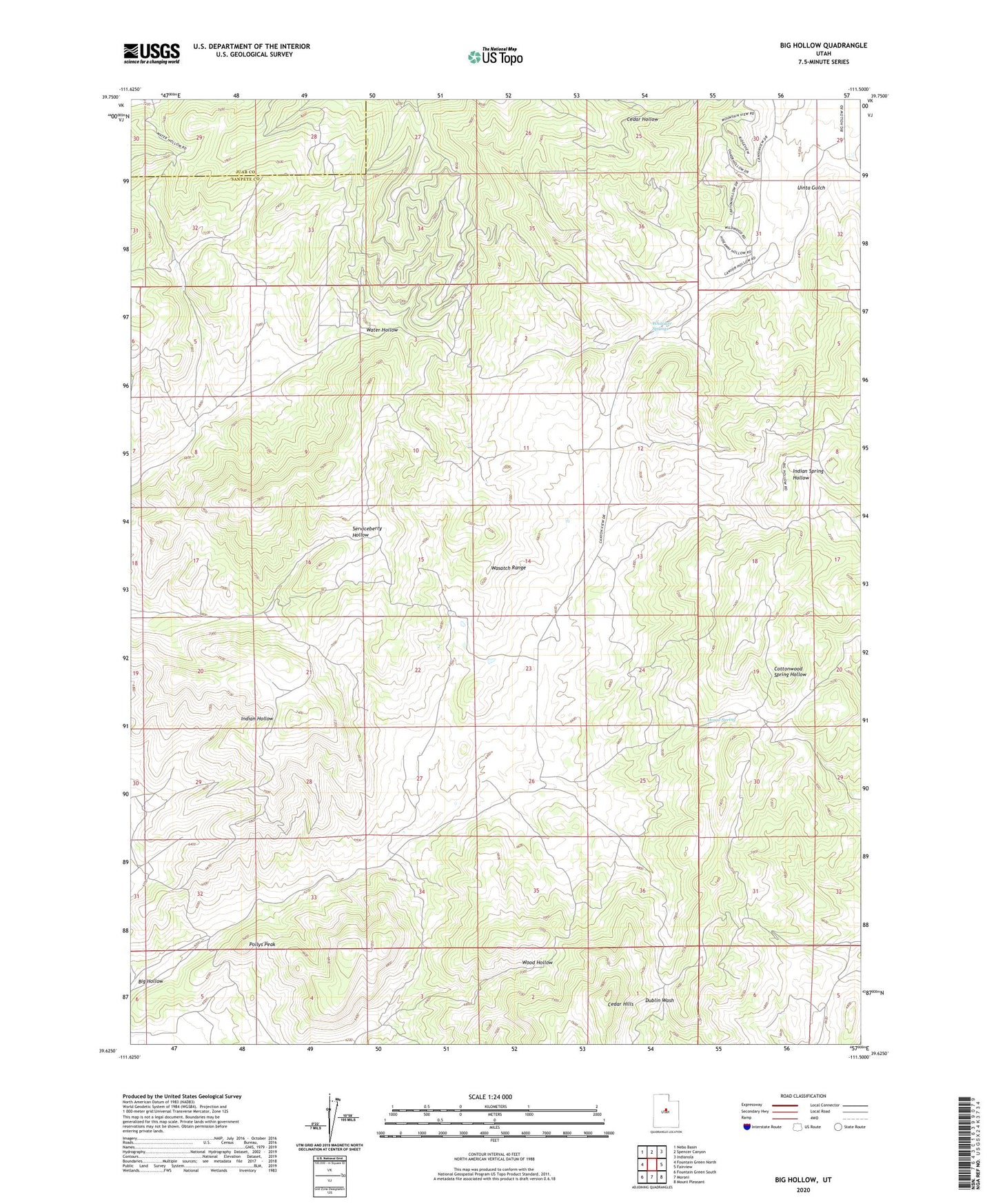
2020 topographic map quadrangle Big Hollow in the state of Utah. Scale: 1:24000. Based on the newly updated USGS 7.5' US Topo map series, this map is in the following counties: Sanpete, Juab. The map contains contour data, water features, and other items you are used to seeing on USGS maps, but also has updated roads and other features. This is the next generation of topographic maps. Printed on high-quality waterproof paper with UV fade-resistant inks.
Quads adjacent to this one:
West: Fountain Green North
Northwest: Nebo Basin
North: Spencer Canyon
Northeast: Indianola
East: Fairview
Southeast: Mount Pleasant
South: Moroni
Southwest: Fountain Green South
Contains the following named places: Big Hollow, Big Hollow Wildlife Management Area, Cedar Hills, House Spring, Pollys Peak, Uinta Gulch, Whitaker Springs