MyTopo
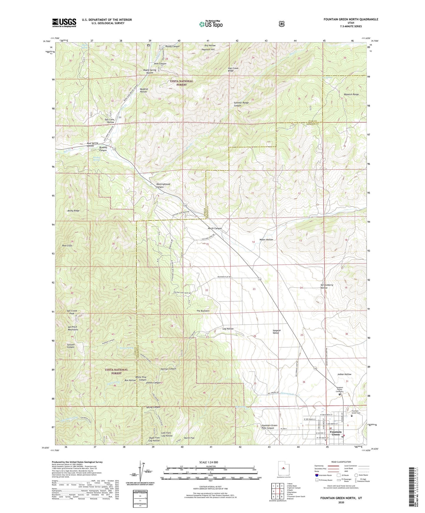
Fountain Green North Utah US Topo Map
Couldn't load pickup availability
Also explore the Fountain Green North Forest Service Topo of this same quad for updated USFS data
2023 topographic map quadrangle Fountain Green North in the state of Utah. Scale: 1:24000. Based on the newly updated USGS 7.5' US Topo map series, this map is in the following counties: Juab, Sanpete. The map contains contour data, water features, and other items you are used to seeing on USGS maps, but also has updated roads and other features. This is the next generation of topographic maps. Printed on high-quality waterproof paper with UV fade-resistant inks.
Quads adjacent to this one:
West: Nephi
Northwest: Mona
North: Nebo Basin
Northeast: Spencer Canyon
East: Big Hollow
Southeast: Moroni
South: Fountain Green South
Southwest: Levan
This map covers the same area as the classic USGS quad with code o39111f6.
Contains the following named places: Big Springs, Box Hollow, Bradley Canyon, Bradley Springs, Cazier Fork, City of Fountain Green, Fountain Green, Fountain Green Cemetery, Fountain Green Fish Hatchery, Fountain Green Pole Canyon, Fountain Green Police Department, Fountain Green Post Office, Fountain Green School, Fountain Green Volunteer Fire Department, Gammett Creek, Haystack Hill, Holman Canyon, Holman Spring, Hop Creek, Indian Hollow, Jewkes Canyon, Left Fork Log Hollow, Log Hollow, Maple Spring, Maple Spring Hollow, Meetinghouse Canyon, Mud Spring Hollow, North Canyon, North Flat, Pine Spring, Pole Canyon, Pole Creek, Quadrat Hollow, Red Cliffs, Right Fork Log Hollow, Rocky Ridge, Rolley Canyon, Salt Cave Hollow, Salt Creek Peak, Serviceberry Hollow, Skyline Trail, Spring Canyon, Summer Range Canyon, The Buckskin, The Church of Jesus Christ of Latter Day Saints, Water Hollow, White Pine Canyon, Yorgason Family Cemetary