MyTopo
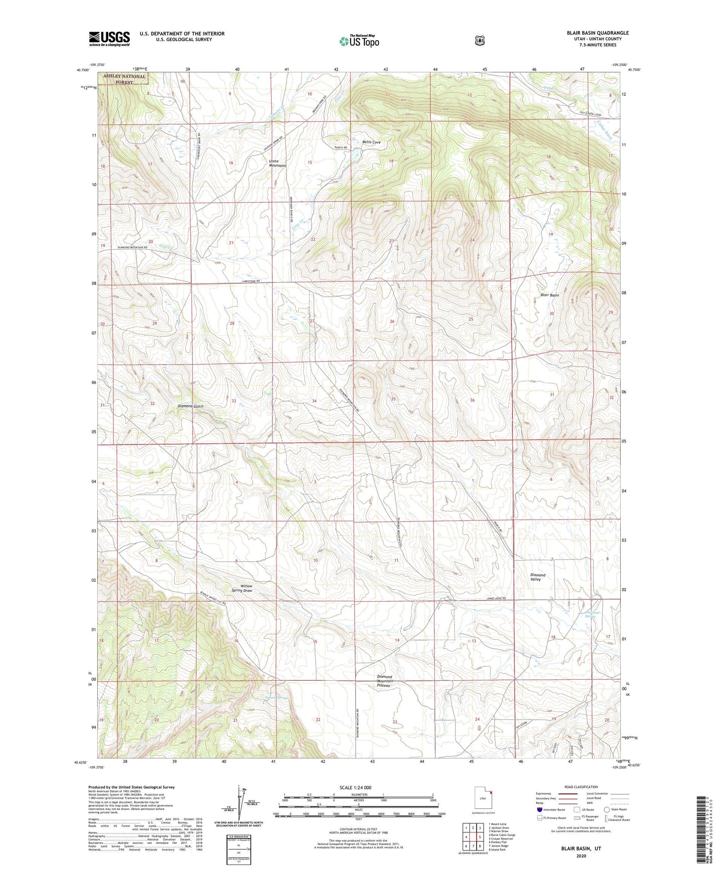
Blair Basin Utah US Topo Map
Couldn't load pickup availability
Also explore the Blair Basin Forest Service Topo of this same quad for updated USFS data
2023 topographic map quadrangle Blair Basin in the state of Utah. Scale: 1:24000. Based on the newly updated USGS 7.5' US Topo map series, this map is in the following counties: Uintah. The map contains contour data, water features, and other items you are used to seeing on USGS maps, but also has updated roads and other features. This is the next generation of topographic maps. Printed on high-quality waterproof paper with UV fade-resistant inks.
Quads adjacent to this one:
West: Burnt Cabin Gorge
Northwest: Mount Lena
North: Jackson Draw
Northeast: Warren Draw
East: Crouse Reservoir
Southeast: Island Park
South: Jensen Ridge
Southwest: Donkey Flat
This map covers the same area as the classic USGS quad with code o40109f3.
Contains the following named places: Betts Cove, Blair Basin, Carl Searle Ranch, Diamond Mountain Plateau, Diamond Spring, Diamond Valley, Freestone Ranch, Goodrich Ranch, McKeachnie Ranch, Squaw Spring, Willis Ranch, Willow Spring Draw