MyTopo
Burnt Cabin Gorge Utah US Topo Map
Couldn't load pickup availability
Also explore the Burnt Cabin Gorge Forest Service Topo of this same quad for updated USFS data
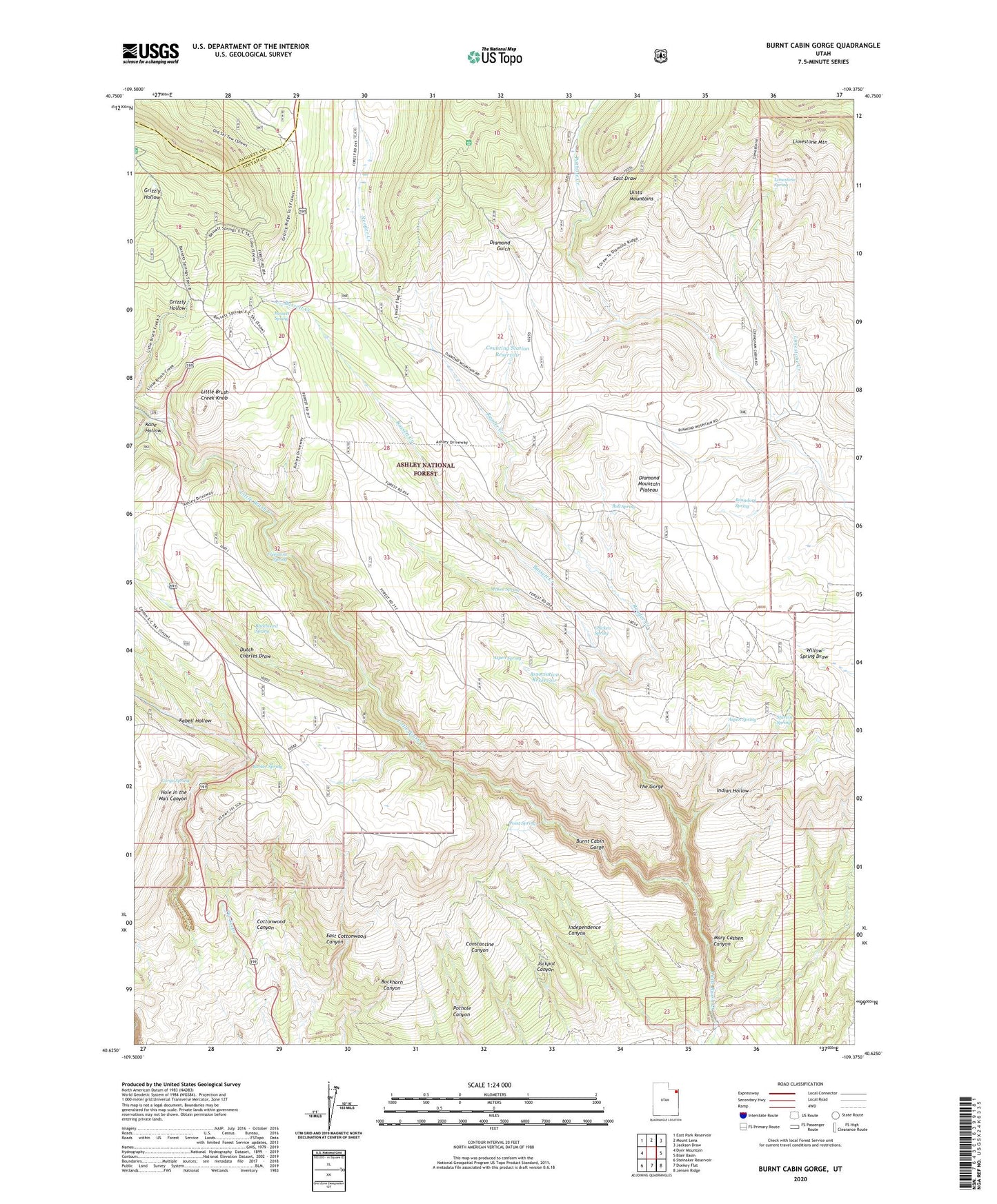
2023 topographic map quadrangle Burnt Cabin Gorge in the state of Utah. Scale: 1:24000. Based on the newly updated USGS 7.5' US Topo map series, this map is in the following counties: Uintah, Daggett. The map contains contour data, water features, and other items you are used to seeing on USGS maps, but also has updated roads and other features. This is the next generation of topographic maps. Printed on high-quality waterproof paper with UV fade-resistant inks.
Quads adjacent to this one:
West: Dyer Mountain
Northwest: East Park Reservoir
North: Mount Lena
Northeast: Jackson Draw
East: Blair Basin
Southeast: Jensen Ridge
South: Donkey Flat
Southwest: Steinaker Reservoir
This map covers the same area as the classic USGS quad with code o40109f4.
Contains the following named places: Aspen Spring, Association Reservoir, Barker Spring, Bassett Creek, Bassett Spring, Boundary Spring, Buckboard Spring, Bull Spring, Burnt Cabin Gorge, Chicken Spring, Counting Station Reservoir, Diamond Counting Corral, Drive Through the Ages Geological Area, Dutch Charles Draw, East Draw, Freestone Spring, Gorge Spring, Independence Canyon, Indian Hollow, Kabell Hollow, Kane Hollow, Limestone Creek, Limestone Mountain, Limestone Spring, Little Brush Creek Knob, Marvin Spring, Mary Cashen Canyon, McKee Spring, Point Spring, Pothole Creek, Reader Creek, The Gorge, The Seeps, ZIP Code: 84078