MyTopo
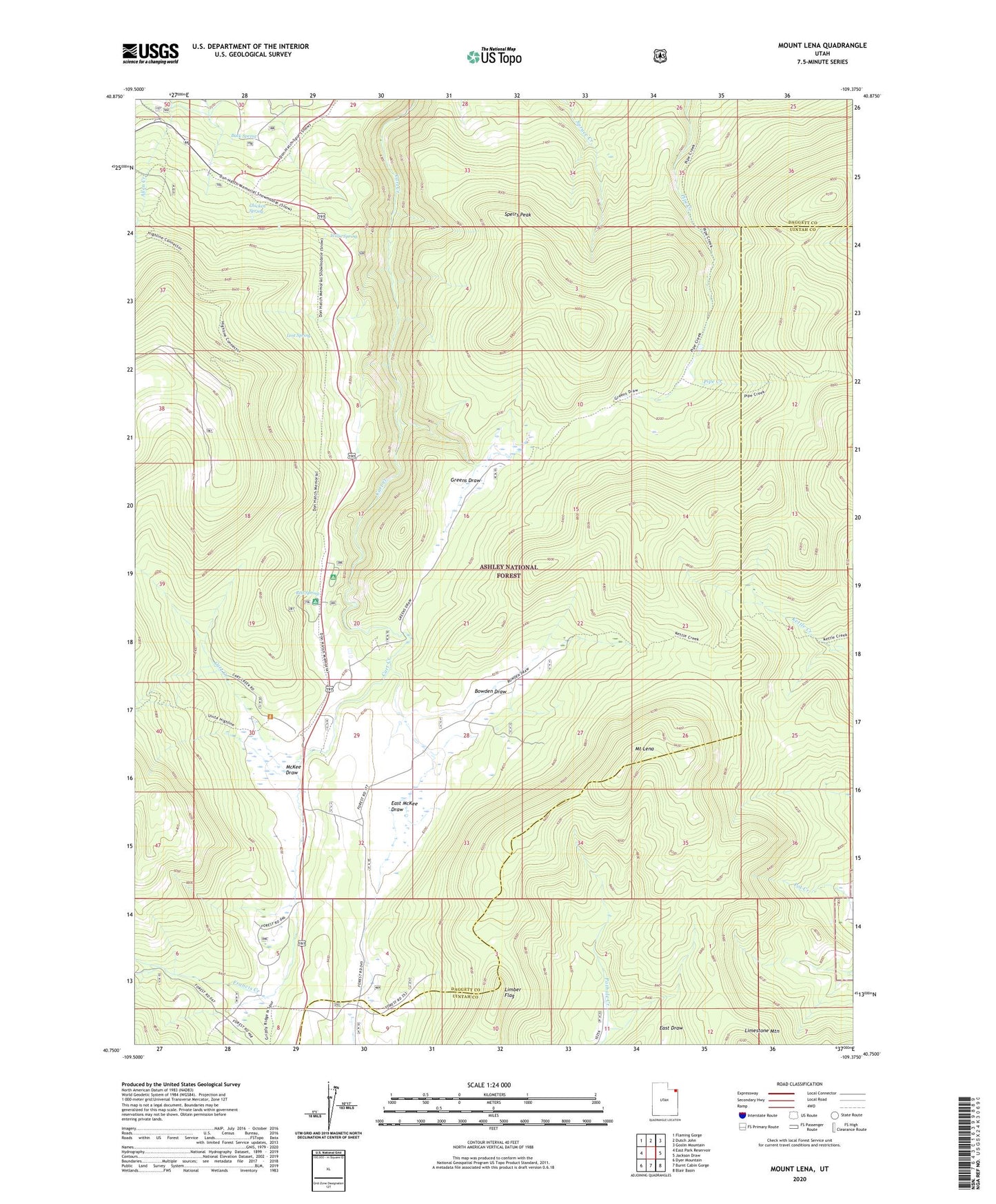
Mount Lena Utah US Topo Map
Couldn't load pickup availability
Also explore the Mount Lena Forest Service Topo of this same quad for updated USFS data
2023 topographic map quadrangle Mount Lena in the state of Utah. Scale: 1:24000. Based on the newly updated USGS 7.5' US Topo map series, this map is in the following counties: Daggett, Uintah. The map contains contour data, water features, and other items you are used to seeing on USGS maps, but also has updated roads and other features. This is the next generation of topographic maps. Printed on high-quality waterproof paper with UV fade-resistant inks.
Quads adjacent to this one:
West: East Park Reservoir
Northwest: Flaming Gorge
North: Dutch John
Northeast: Goslin Mountain
East: Jackson Draw
Southeast: Blair Basin
South: Burnt Cabin Gorge
Southwest: Dyer Mountain
This map covers the same area as the classic USGS quad with code o40109g4.
Contains the following named places: Bowden Draw, Buck Spring, Chicken Spring, Deer Lodge Summer Home Area, East McKee Draw, Francis Creek, Greendale Canal, Greendale Junction, Greens Draw, Greensdale Overlook, Grizzly Ridge Winter Sports Area, Limber Flag, Lodgepole Campground, Lost Spring, McKee Draw, Mount Lena, Red Spring, Red Spring Campground, Speirs Peak, Stringham Cabin, Willie Spring