MyTopo
Jackson Draw Utah US Topo Map
Couldn't load pickup availability
Also explore the Jackson Draw Forest Service Topo of this same quad for updated USFS data
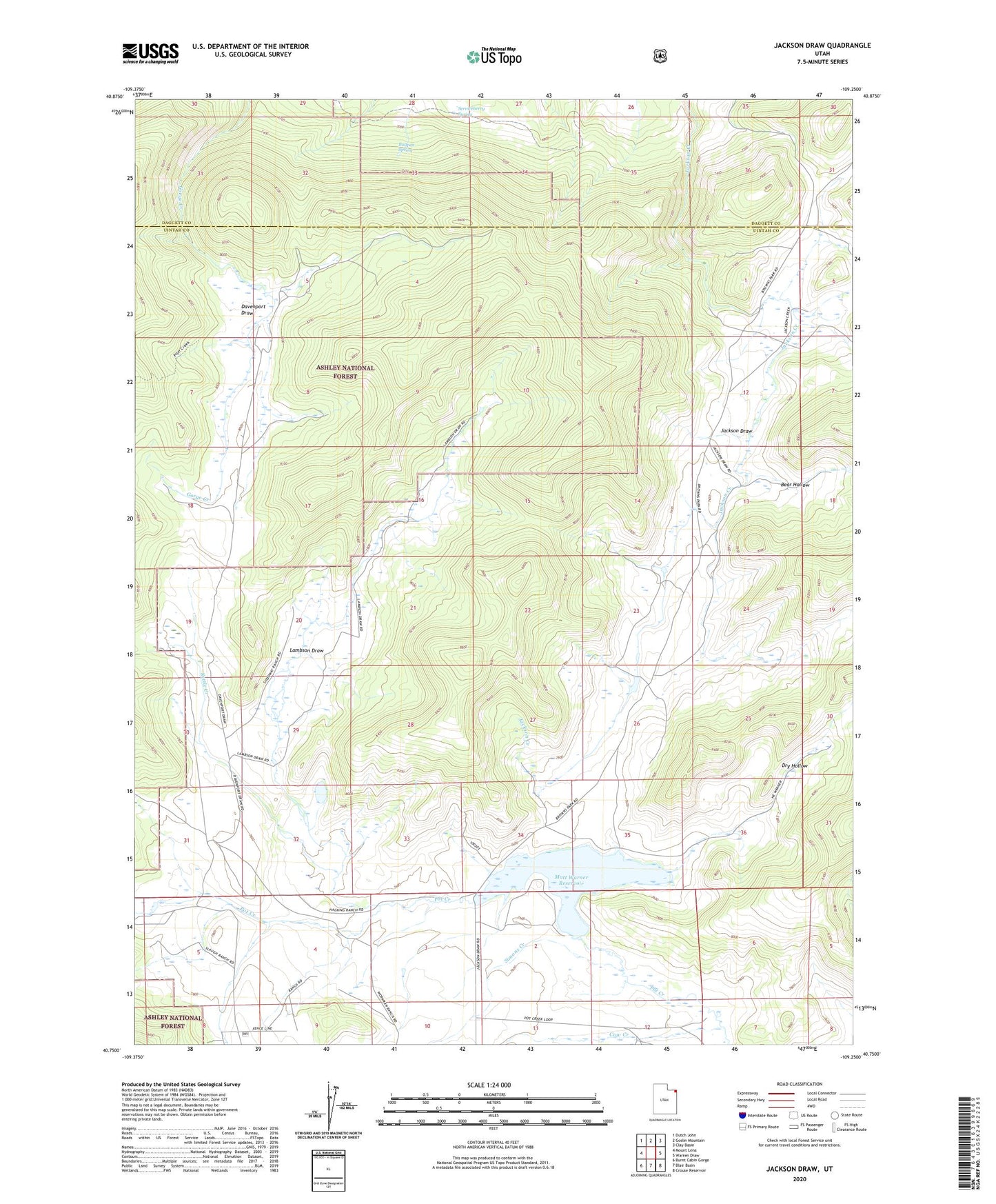
2023 topographic map quadrangle Jackson Draw in the state of Utah. Scale: 1:24000. Based on the newly updated USGS 7.5' US Topo map series, this map is in the following counties: Uintah, Daggett. The map contains contour data, water features, and other items you are used to seeing on USGS maps, but also has updated roads and other features. This is the next generation of topographic maps. Printed on high-quality waterproof paper with UV fade-resistant inks.
Quads adjacent to this one:
West: Mount Lena
Northwest: Dutch John
North: Goslin Mountain
Northeast: Clay Basin
East: Warren Draw
Southeast: Crouse Reservoir
South: Blair Basin
Southwest: Burnt Cabin Gorge
This map covers the same area as the classic USGS quad with code o40109g3.
Contains the following named places: Bear Hollow, Bullpen Spring, Cow Creek, Davenport Draw, Dry Hollow, Jackson Draw, Kettle Creek, Lambson Draw, Matt Warner Dam, Matt Warner Reservoir, Serviceberry Spring, Simons Creek