MyTopo
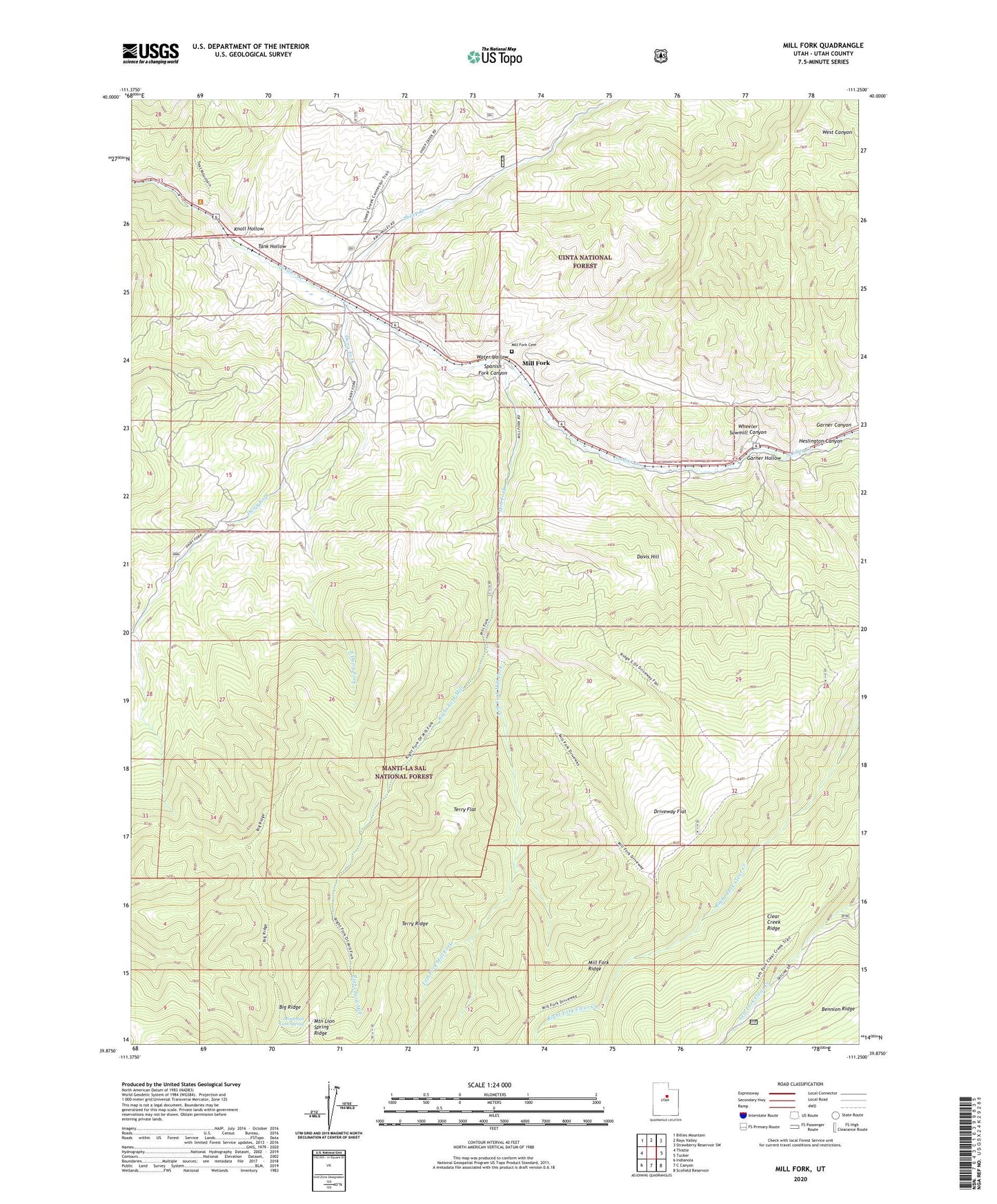
Mill Fork Utah US Topo Map
Couldn't load pickup availability
Also explore the Mill Fork Forest Service Topo of this same quad for updated USFS data
2023 topographic map quadrangle Mill Fork in the state of Utah. Scale: 1:24000. Based on the newly updated USGS 7.5' US Topo map series, this map is in the following counties: Utah. The map contains contour data, water features, and other items you are used to seeing on USGS maps, but also has updated roads and other features. This is the next generation of topographic maps. Printed on high-quality waterproof paper with UV fade-resistant inks.
Quads adjacent to this one:
West: Thistle
Northwest: Billies Mountain
North: Rays Valley
Northeast: Strawberry Reservoir SW
East: Tucker
Southeast: Scofield Reservoir
South: C Canyon
Southwest: Indianola
This map covers the same area as the classic USGS quad with code o39111h3.
Contains the following named places: Big Ridge, Dairy Fork, Dairy Fork Wildlife Management Area, Davis Hill, Driveway Flat, East Dairy Fork, Garner Canyon, Heslington Canyon, Knoll Hollow, Left Fork Mill Fork, Mill Fork, Mill Fork Cemetery, Mountain Lion Spring, Mountain Lion Spring Ridge, Narrows, Right Fork Mill Fork, Sheep Creek, Tank Hollow, Terry Flat, Water Hollow, Wheeler Sawmill Canyon