MyTopo
Callao Utah US Topo Map
Couldn't load pickup availability
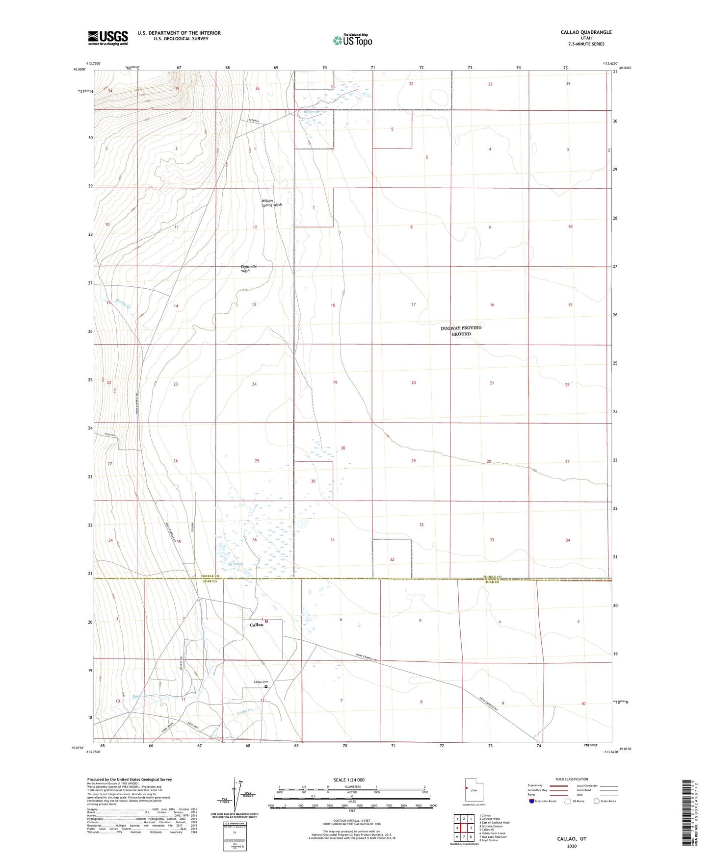
2023 topographic map quadrangle Callao in the state of Utah. Scale: 1:24000. Based on the newly updated USGS 7.5' US Topo map series, this map is in the following counties: Tooele, Juab. The map contains contour data, water features, and other items you are used to seeing on USGS maps, but also has updated roads and other features. This is the next generation of topographic maps. Printed on high-quality waterproof paper with UV fade-resistant inks.
Quads adjacent to this one:
West: Goshute Canyon
Northwest: Clifton
North: Goshute Wash
Northeast: East of Goshute Wash
East: Callao NE
Southeast: Boyd Station
South: Mud Lake Reservoir
Southwest: Indian Farm Creek
This map covers the same area as the classic USGS quad with code o39113h6.
Contains the following named places: Basin Creek, Big Spring, Callao, Callao Cemetery, Callao Fire Department, Eightmile Wash, Jacobs Hole, Jesses Wells, Redden Springs, Reilly Creek, Swimming Hole, The Church of Jesus Christ of Latter Day Saints, Toms Creek, Willow Spring Wash, Willow Springs Station