MyTopo
Sunnyside Utah US Topo Map
Couldn't load pickup availability
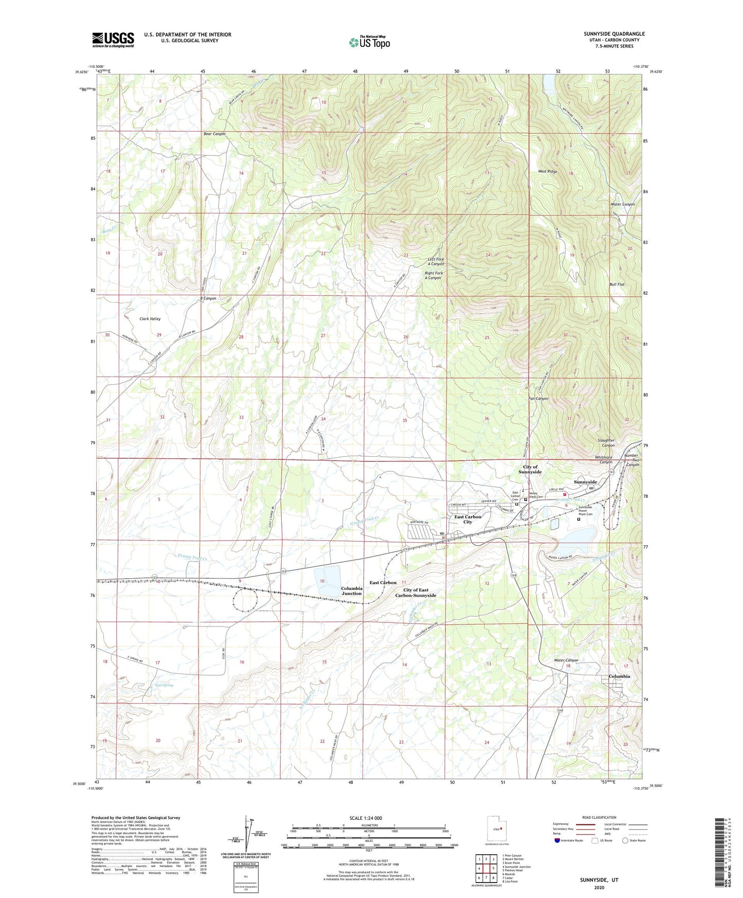
2023 topographic map quadrangle Sunnyside in the state of Utah. Scale: 1:24000. Based on the newly updated USGS 7.5' US Topo map series, this map is in the following counties: Carbon. The map contains contour data, water features, and other items you are used to seeing on USGS maps, but also has updated roads and other features. This is the next generation of topographic maps. Printed on high-quality waterproof paper with UV fade-resistant inks.
Quads adjacent to this one:
West: Sunnyside Junction
Northwest: Pine Canyon
North: Mount Bartles
Northeast: Bruin Point
East: Patmos Head
Southeast: Lila Point
South: Cedar
Southwest: Mounds
This map covers the same area as the classic USGS quad with code o39110e4.
Contains the following named places: B Canyon, Bear Canyon, Bull Flat, City of East Carbon, City of East Carbon-Sunnyside, City of Sunnyside, Columbia, Columbia Junction, Dragerton, East Carbon Cemetery, East Carbon City, East Carbon Fire Department, East Carbon High School, East Carbon Police Department, East Carbon Post Office, East Spring, Fan Canyon, Good Shepherd Catholic Church, Grassy Trail Dam, Grassy Trail Reservoir, Left Fork A Canyon, Number Two Canyon, Peterson School, Pierson Ranch, Right Fork A Canyon, Slaughter Canyon, Sunnydale, Sunnyside, Sunnyside Ambulance Service, Sunnyside Fire Department, Sunnyside Post Office, Sunnyside Power Plant Cemetery, The Church of Jesus Christ of Latter Day Saints, Trinity Episcopal Church, Valley View Cemetery, Water Canyon, Whitmore Canyon, ZIP Code: 84520