MyTopo
Cinder Crater Utah US Topo Map
Couldn't load pickup availability
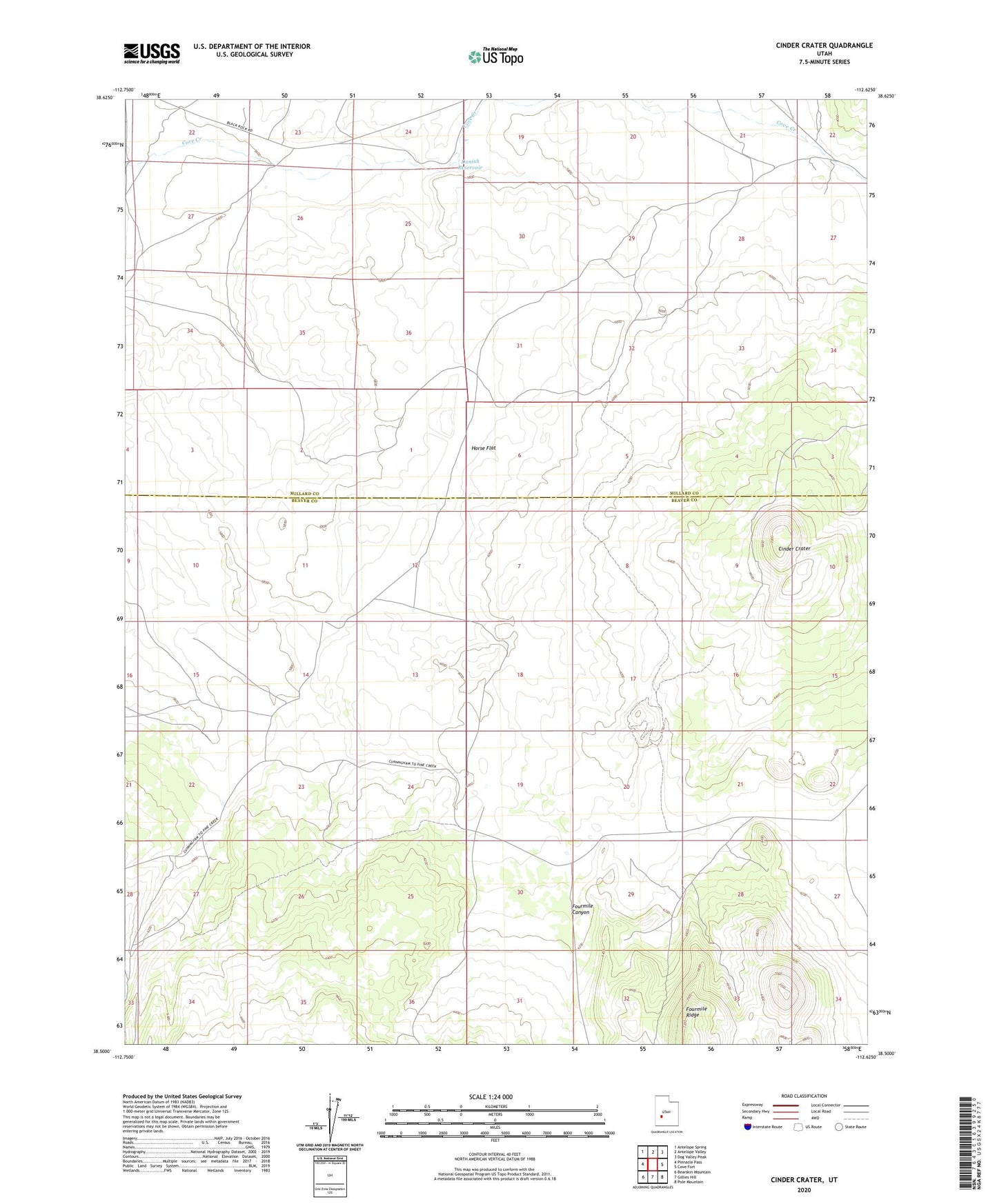
2023 topographic map quadrangle Cinder Crater in the state of Utah. Scale: 1:24000. Based on the newly updated USGS 7.5' US Topo map series, this map is in the following counties: Beaver, Millard. The map contains contour data, water features, and other items you are used to seeing on USGS maps, but also has updated roads and other features. This is the next generation of topographic maps. Printed on high-quality waterproof paper with UV fade-resistant inks.
Quads adjacent to this one:
West: Pinnacle Pass
Northwest: Antelope Spring
North: Antelope Valley
Northeast: Dog Valley Peak
East: Cove Fort
Southeast: Pole Mountain
South: Gillies Hill
Southwest: Bearskin Mountain
This map covers the same area as the classic USGS quad with code o38112e6.
Contains the following named places: Cedar Grove, Cinder Crater, Danish Reservoir, Fourmile Canyon, Horse Flat, Water Canyon