MyTopo
Gillies Hill Utah US Topo Map
Couldn't load pickup availability
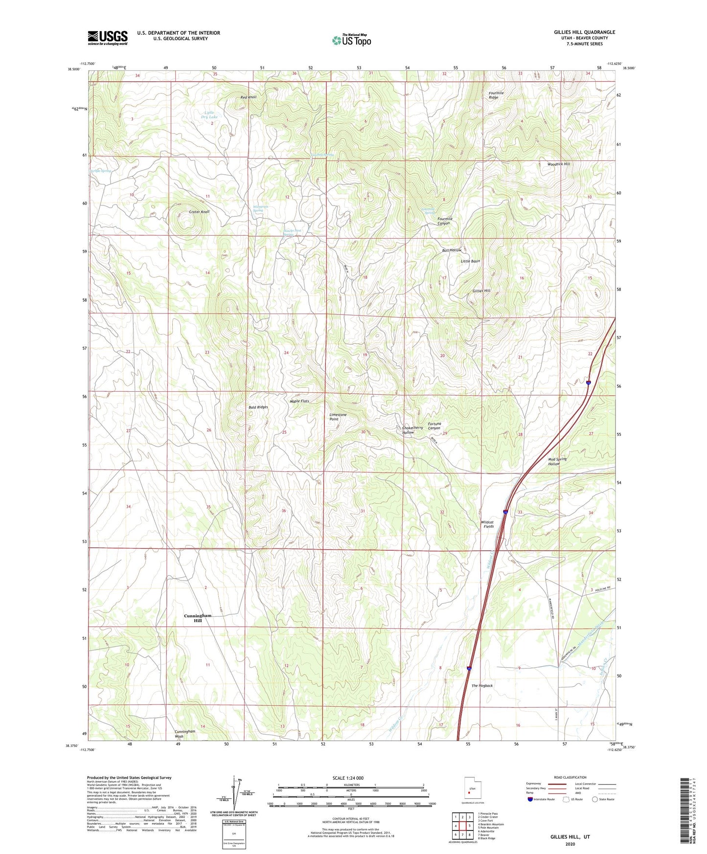
2023 topographic map quadrangle Gillies Hill in the state of Utah. Scale: 1:24000. Based on the newly updated USGS 7.5' US Topo map series, this map is in the following counties: Beaver. The map contains contour data, water features, and other items you are used to seeing on USGS maps, but also has updated roads and other features. This is the next generation of topographic maps. Printed on high-quality waterproof paper with UV fade-resistant inks.
Quads adjacent to this one:
West: Bearskin Mountain
Northwest: Pinnacle Pass
North: Cinder Crater
Northeast: Cove Fort
East: Pole Mountain
Southeast: Black Ridge
South: Beaver
Southwest: Adamsville
This map covers the same area as the classic USGS quad with code o38112d6.
Contains the following named places: Bald Ridges, Chokecherry Hollow, Cowboy Spring, Crater Knoll, Cunningham Hill, Fortuna Canyon, Fortune Mine, Fourmile Ridge, Fourmile Spring, Gillies Hill, Harris Mine, Hawks Nest Spring, Limestone Point, Little Basin, Little Dry Lake, Maple Flats, Mud Spring Hollow, Red Knoll, Wildcat Fields, Wiregrass Spring, Woodtick Hill