MyTopo
Coalville Utah US Topo Map
Couldn't load pickup availability
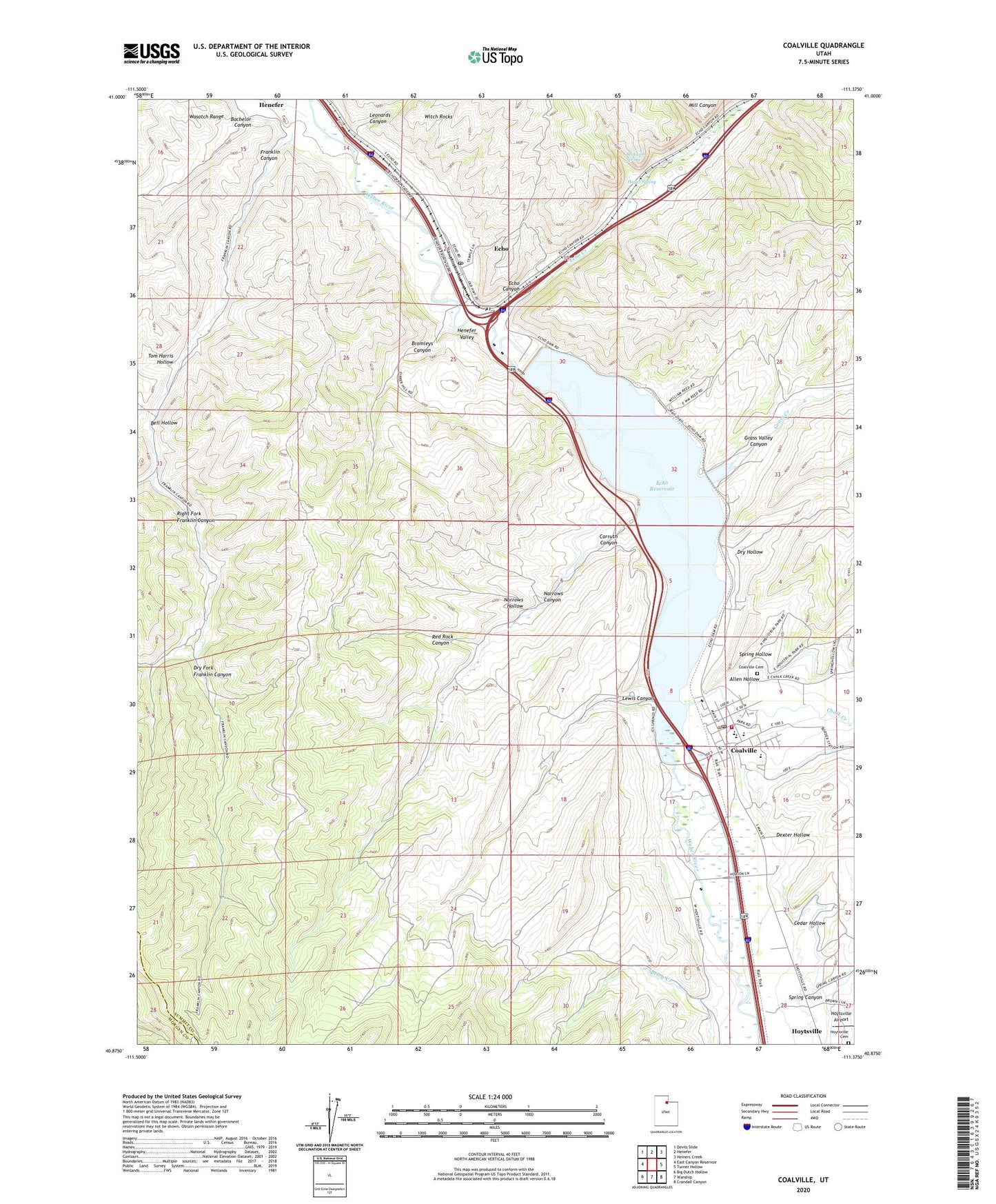
2020 topographic map quadrangle Coalville in the state of Utah. Scale: 1:24000. Based on the newly updated USGS 7.5' US Topo map series, this map is in the following counties: Summit, Morgan. The map contains contour data, water features, and other items you are used to seeing on USGS maps, but also has updated roads and other features. This is the next generation of topographic maps. Printed on high-quality waterproof paper with UV fade-resistant inks.
Quads adjacent to this one:
West: East Canyon Reservoir
Northwest: Devils Slide
North: Henefer
Northeast: Heiners Creek
East: Turner Hollow
Southeast: Crandall Canyon
South: Wanship
Southwest: Big Dutch Hollow
Contains the following named places: Allen Hollow, Bachelor Canyon, Beckwith Spring, Bell Hollow, Bromleys Canyon, Carruth Canyon, Cedar Hollow, Chalk Creek, City of Coalville, Coalville, Coalville Cemetery, Coalville Post Office, Dexter Hollow, Dry Fork Franklin Canyon, Dry Hollow, Echo, Echo Canyon, Echo Census Designated Place, Echo Creek, Echo Dam, Echo Historical Cemetery, Echo Post Office, Echo Reservoir, Echo Resort, Franklin Canyon, Grass Creek, Grass Valley Canyon, Hayes Spring, Holiday Hills Campground, Hoytsville Airport, Hoytsville Cemetery, Hoytsville Census Designated Place, Knight Hawk Helicopter Service, Leonards Canyon, Lewis Canyon, Mill Canyon, Narrows Canyon, Narrows Hollow, North Summit EMS Ambulance, North Summit Fire District Station 21 Coalville, North Summit High School, North Summit Middle School, North Summit Preschool, Red Rock Canyon, Right Fork Franklin Canyon, Spring Canyon, Spring Creek, Spring Hollow, Summit County Hospital Heliport, The Church of Jesus Christ of Latter Day Saints, Tom Harris Hollow, Witch Rocks