MyTopo
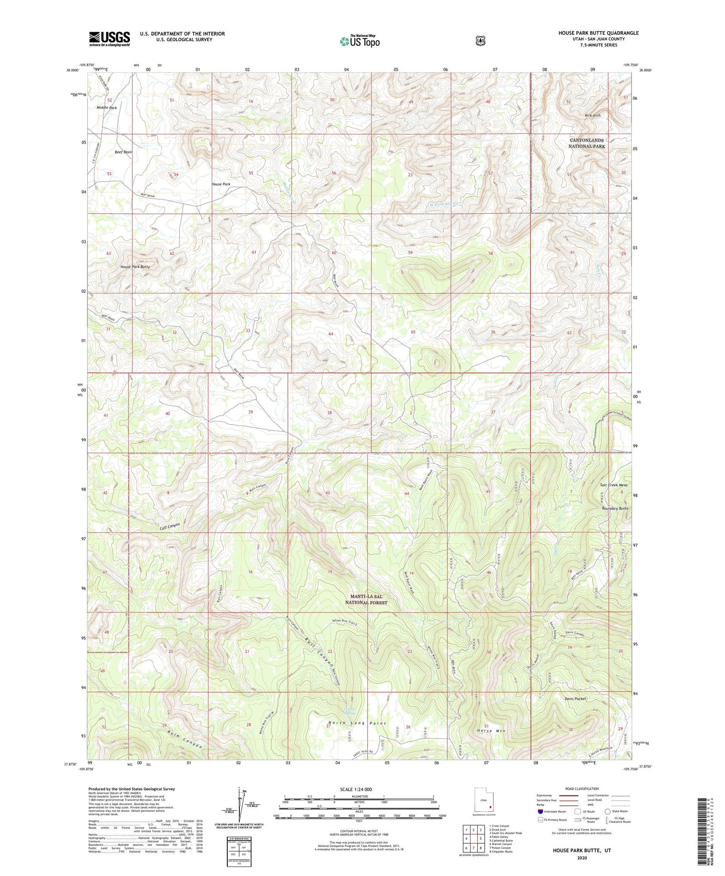
House Park Butte Utah US Topo Map
Couldn't load pickup availability
Also explore the House Park Butte Forest Service Topo of this same quad for updated USFS data
2023 topographic map quadrangle House Park Butte in the state of Utah. Scale: 1:24000. Based on the newly updated USGS 7.5' US Topo map series, this map is in the following counties: San Juan. The map contains contour data, water features, and other items you are used to seeing on USGS maps, but also has updated roads and other features. This is the next generation of topographic maps. Printed on high-quality waterproof paper with UV fade-resistant inks.
Quads adjacent to this one:
West: Fable Valley
Northwest: Cross Canyon
North: Druid Arch
Northeast: South Six-shooter Peak
East: Cathedral Butte
Southeast: Chippean Rocks
South: Poison Canyon
Southwest: Warren Canyon
This map covers the same area as the classic USGS quad with code o37109h7.
Contains the following named places: Bright Angel Trail, Crystal Spring, Horse Mountain, House Park, House Park Butte, Kirk Arch, Middle Park, Tse Nizh'oni-Stellar Arch