MyTopo
Deer Spring Point Utah US Topo Map
Couldn't load pickup availability
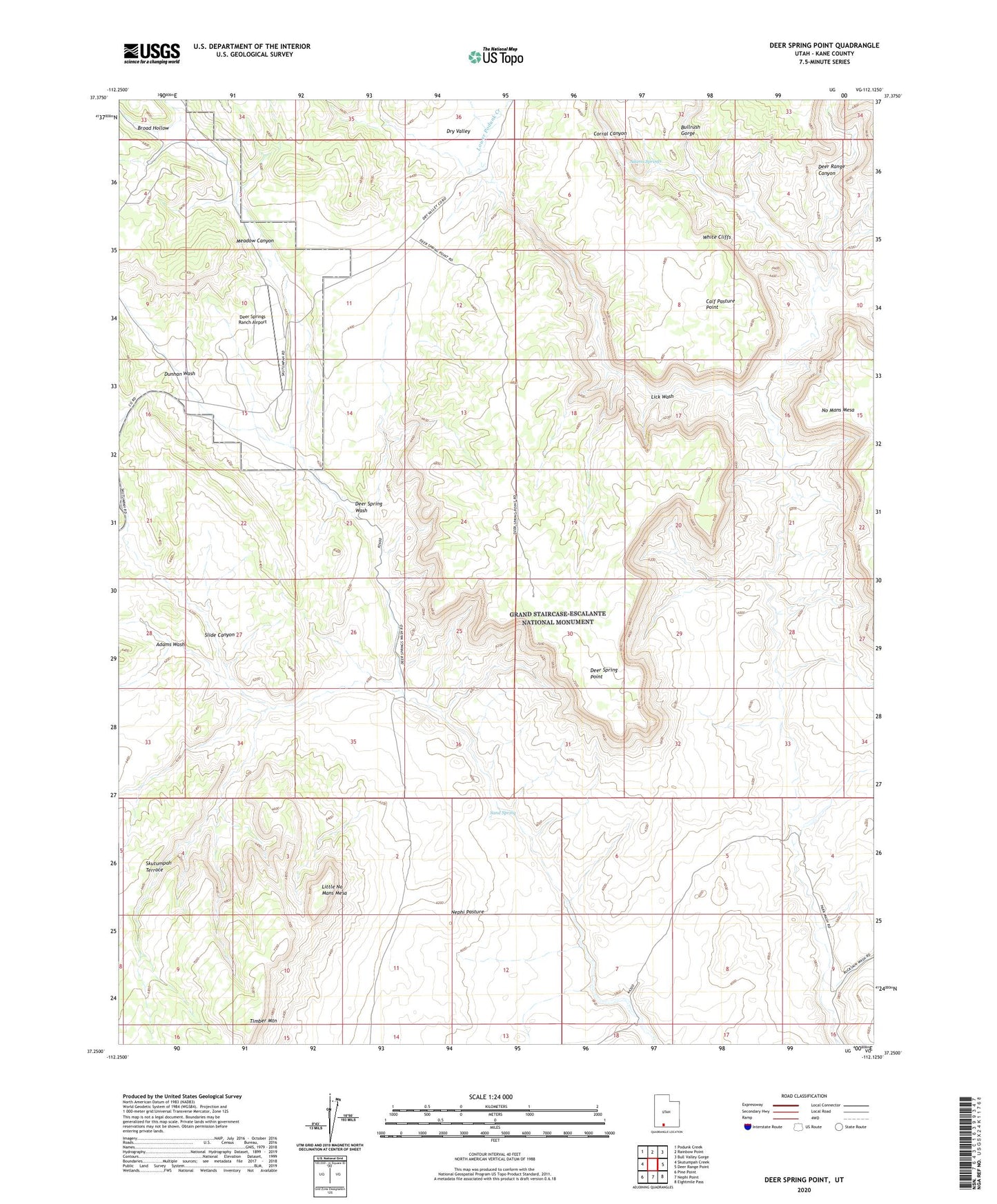
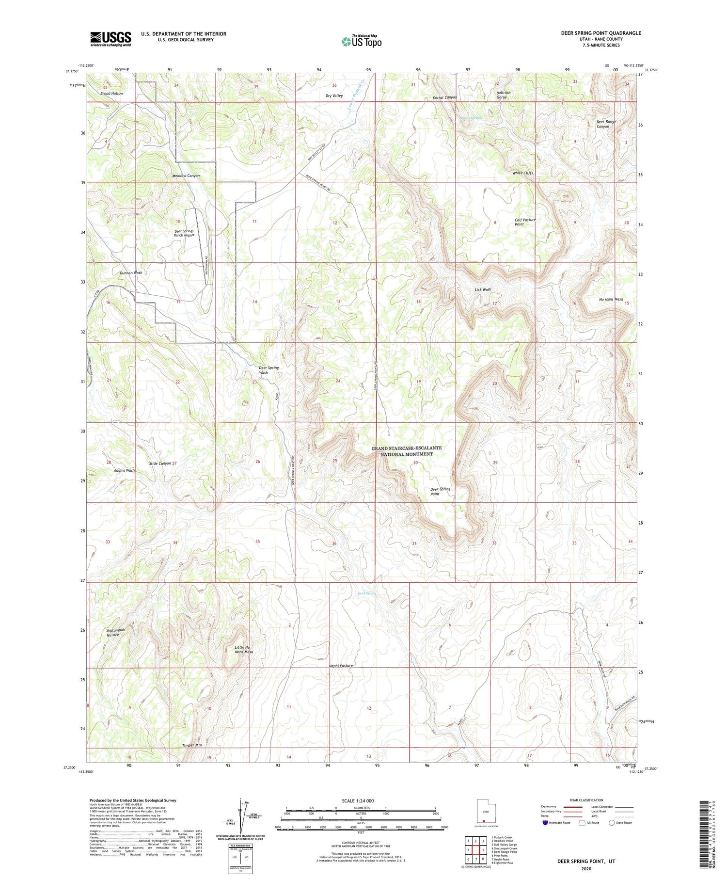
2020 topographic map quadrangle Deer Spring Point in the state of Utah. Scale: 1:24000. Based on the newly updated USGS 7.5' US Topo map series, this map is in the following counties: Kane. The map contains contour data, water features, and other items you are used to seeing on USGS maps, but also has updated roads and other features. This is the next generation of topographic maps. Printed on high-quality waterproof paper with UV fade-resistant inks.
Quads adjacent to this one:
West: Skutumpah Creek
Northwest: Podunk Creek
North: Rainbow Point
Northeast: Bull Valley Gorge
East: Deer Range Point
Southeast: Eightmile Pass
South: Nephi Point
Southwest: Pine Point
Contains the following named places: Adams Springs, Adams Wash, Broad Hollow, Bullrush Gorge, Calf Pasture Point, Coal Canyon, Corral Canyon, Deer Range Canyon, Deer Spring Point, Deer Springs Ranch Airport, Dunhan Wash, Findlay Ranch, Lick Wash, Little No Mans Mesa, Lower Podunk Creek, Meadow Canyon, Sand Spring, Slide Canyon