MyTopo
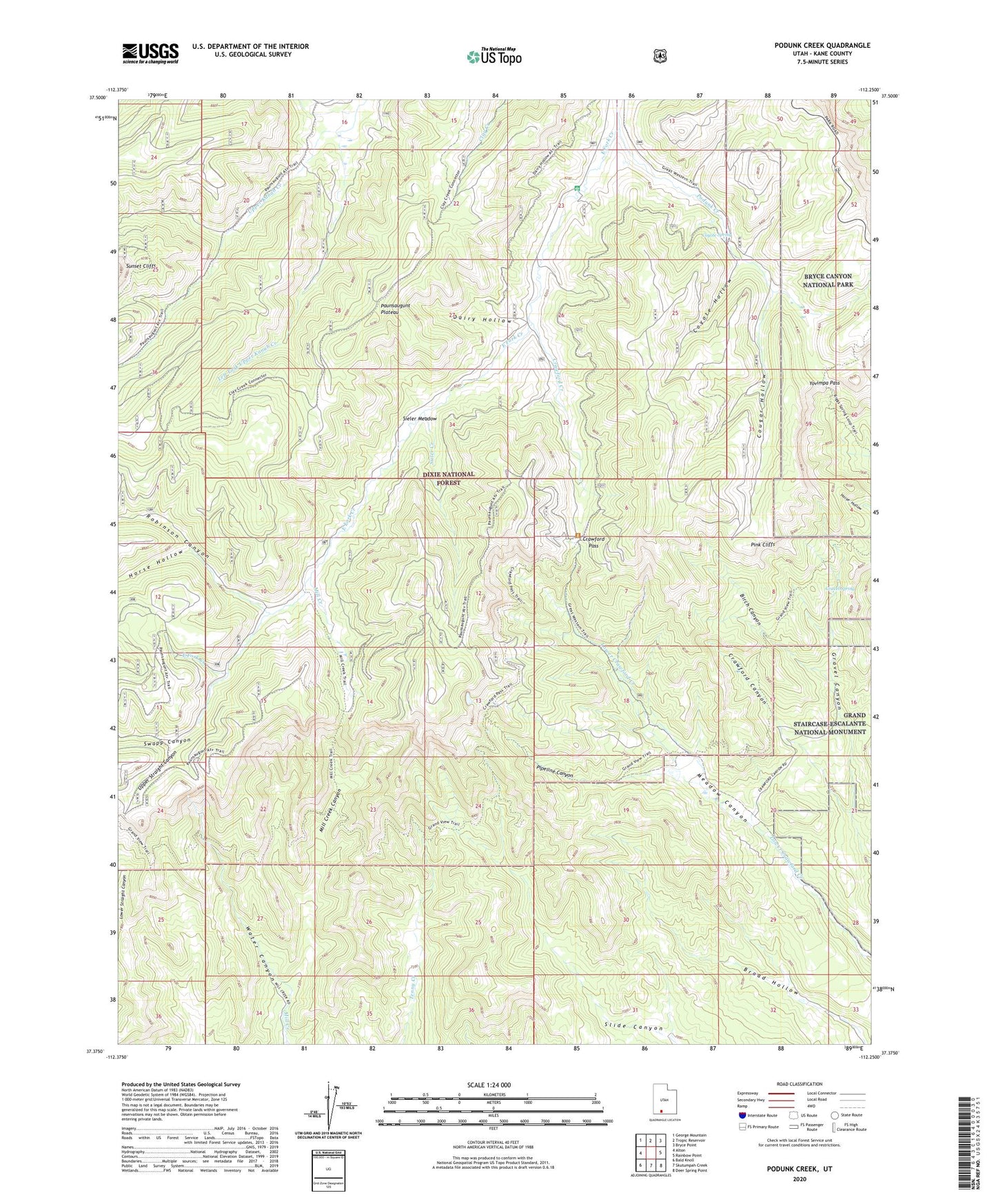
Podunk Creek Utah US Topo Map
Couldn't load pickup availability
Also explore the Podunk Creek Forest Service Topo of this same quad for updated USFS data
2023 topographic map quadrangle Podunk Creek in the state of Utah. Scale: 1:24000. Based on the newly updated USGS 7.5' US Topo map series, this map is in the following counties: Kane. The map contains contour data, water features, and other items you are used to seeing on USGS maps, but also has updated roads and other features. This is the next generation of topographic maps. Printed on high-quality waterproof paper with UV fade-resistant inks.
Quads adjacent to this one:
West: Alton
Northwest: George Mountain
North: Tropic Reservoir
Northeast: Bryce Point
East: Rainbow Point
Southeast: Deer Spring Point
South: Skutumpah Creek
Southwest: Bald Knoll
This map covers the same area as the classic USGS quad with code o37112d3.
Contains the following named places: Birch Canyon, Black Birch Canyon Overlook, Cougar Hollow, Coyote Hollow, Coyote Spring, Crawford Creek, Crawford Pass, Dairy Hollow, East Fork Creek, Gravel Canyon, Gravel Spring, Horse Hollow, Left Fork Upper Kanab Creek, Mill Creek, Mill Creek Canyon, Pink Cliffs Viewing Area, Pipeline Canyon, Podunk Creek, Podunk Guard Station, Ponderosa Canyon Overlook, Right Fork Upper Kanab Creek, Robinson Canyon, Sieler Creek, Sieler Meadow, Swapp Canyon, Upper Straight Canyon, Water Canyon, Yovimpa Pass