MyTopo
Skutumpah Creek Utah US Topo Map
Couldn't load pickup availability
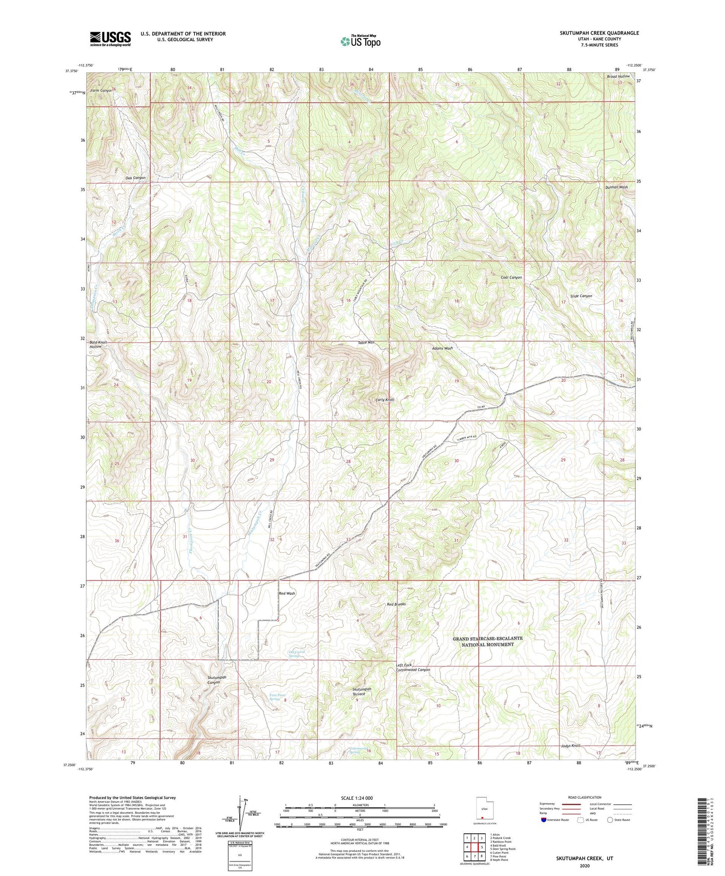
2023 topographic map quadrangle Skutumpah Creek in the state of Utah. Scale: 1:24000. Based on the newly updated USGS 7.5' US Topo map series, this map is in the following counties: Kane. The map contains contour data, water features, and other items you are used to seeing on USGS maps, but also has updated roads and other features. This is the next generation of topographic maps. Printed on high-quality waterproof paper with UV fade-resistant inks.
Quads adjacent to this one:
West: Bald Knoll
Northwest: Alton
North: Podunk Creek
Northeast: Rainbow Point
East: Deer Spring Point
Southeast: Nephi Point
South: Pine Point
Southwest: Cutler Point
This map covers the same area as the classic USGS quad with code o37112c3.
Contains the following named places: Bald Knoll Hollow, Birch Creek, Carly Knoll, Cottonwood Spring, First Point Spring, Jodys Knoll, Lick Creek, Mill Creek, Mineral Creek, Oak Canyon, Old Corral Spring, Red Breaks, Red Wash, Skutumpah Creek, Skutumpah Ranch, Table Mountain, Tenny Creek, Thompson Creek