MyTopo
Donkey Flat Utah US Topo Map
Couldn't load pickup availability
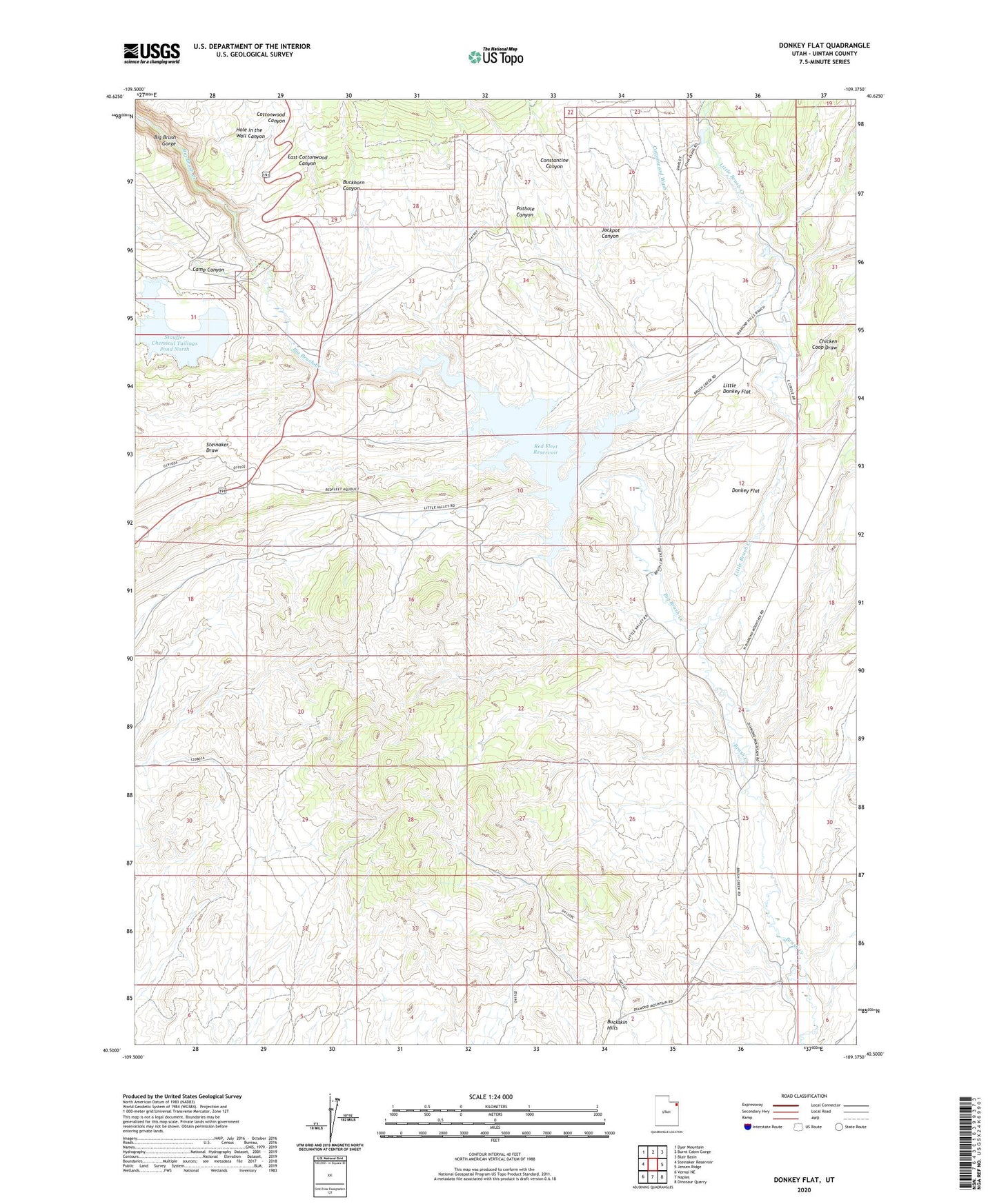
2020 topographic map quadrangle Donkey Flat in the state of Utah. Scale: 1:24000. Based on the newly updated USGS 7.5' US Topo map series, this map is in the following counties: Uintah. The map contains contour data, water features, and other items you are used to seeing on USGS maps, but also has updated roads and other features. This is the next generation of topographic maps. Printed on high-quality waterproof paper with UV fade-resistant inks.
Quads adjacent to this one:
West: Steinaker Reservoir
Northwest: Dyer Mountain
North: Burnt Cabin Gorge
Northeast: Blair Basin
East: Jensen Ridge
Southeast: Dinosaur Quarry
South: Naples
Southwest: Vernal NE
Contains the following named places: Big Brush Creek, Big Brush Gorge, Buckhorn Canyon, Buckskin Hills, Camp Canyon, Chicken Coop Draw, Constantine Canyon, Cottonwood Canyon, Cottonwood Wash, Donkey Flat, East Cottonwood Canyon, Hole in the Wall Canyon, Jackpot Canyon, Little Brush Creek, Little Donkey Flat, Pothole Canyon, Red Fleet Campground, Red Fleet Reservoir, Stauffer Chemical Tailings Pond North, Stauffer Chemical Tailings Pond North Dam, Vernal Division