MyTopo
Steinaker Reservoir Utah US Topo Map
Couldn't load pickup availability
Also explore the Steinaker Reservoir Forest Service Topo of this same quad for updated USFS data
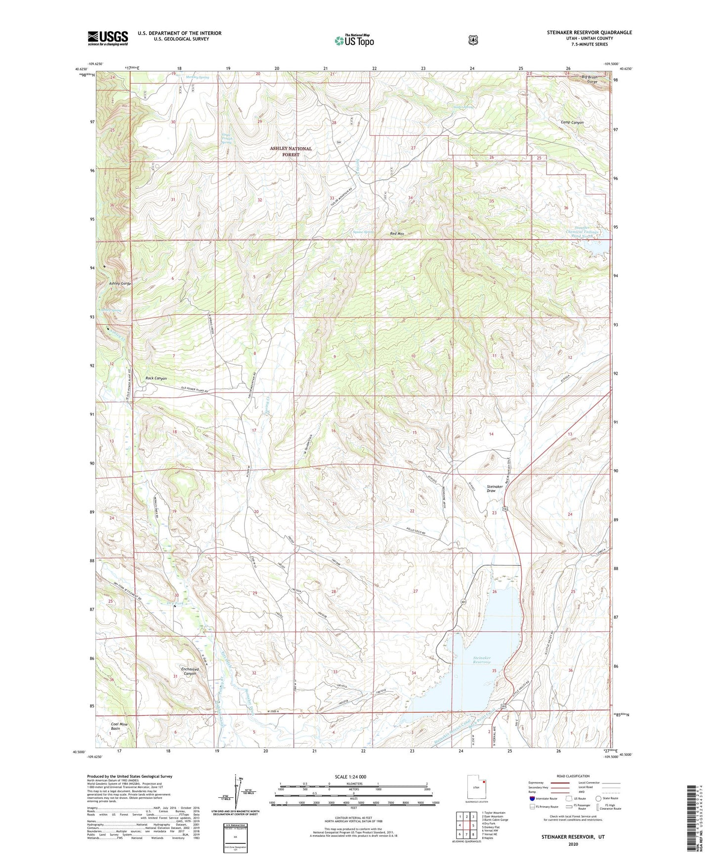
2023 topographic map quadrangle Steinaker Reservoir in the state of Utah. Scale: 1:24000. Based on the newly updated USGS 7.5' US Topo map series, this map is in the following counties: Uintah. The map contains contour data, water features, and other items you are used to seeing on USGS maps, but also has updated roads and other features. This is the next generation of topographic maps. Printed on high-quality waterproof paper with UV fade-resistant inks.
Quads adjacent to this one:
West: Dry Fork
Northwest: Taylor Mountain
North: Dyer Mountain
Northeast: Burnt Cabin Gorge
East: Donkey Flat
Southeast: Naples
South: Vernal NE
Southwest: Vernal NW
This map covers the same area as the classic USGS quad with code o40109e5.
Contains the following named places: Ashley Creek Recreation Site, Ashley Gorge, Ashley Spring, Ashley Substation, Dry Fork, Enchanted Canyon, Little Valley Corral, McConkie Ranch, Merkley Park, Merkley Spring, Pitt Ditch, Red Mountain, Remember the Maine Picnic Site, Rock Canyon, Rock Point Canal, Single Trough Spring, Snider Spring, Spring Creek, Spring Creek Corral, Squaw Spring, Steinaker Campground, Steinaker Dam, Steinaker Ditch, Steinaker Reservoir, Steinaker State Park