MyTopo
Dutch John Utah US Topo Map
Couldn't load pickup availability
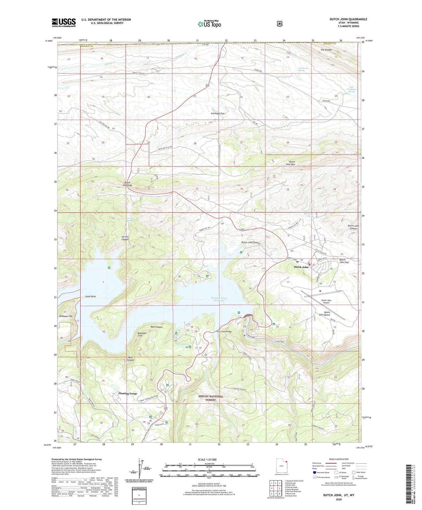
2020 topographic map quadrangle Dutch John in the state of Utah. Scale: 1:24000. Based on the newly updated USGS 7.5' US Topo map series, this map is in the following counties: Daggett, Sweetwater. The map contains contour data, water features, and other items you are used to seeing on USGS maps, but also has updated roads and other features. This is the next generation of topographic maps. Printed on high-quality waterproof paper with UV fade-resistant inks.
Quads adjacent to this one:
West: Flaming Gorge
Northwest: Haystack Buttes South
North: Minnies Gap
Northeast: Hawks Nest
East: Goslin Mountain
Southeast: Jackson Draw
South: Mount Lena
Southwest: East Park Reservoir
Contains the following named places: Alabama Flat, Allen Creek, Antelope Flat, Arch Dam Campground, Bear Canyon, Blacktail Cliff, Bootleg Campground, Canyon Glen Picnic Area, Cart Creek, Cart Creek Bridge, Cedar Spring, Cedar Springs Campground, Daggett County Ambulance Service, Deer Run Campground, Dutch John, Dutch John Airport, Dutch John Bench, Dutch John Boat Ramp, Dutch John Canyon, Dutch John Census Designated Place, Dutch John Draw, Dutch John Draw Campground, Dutch John Fire Department, Dutch John Flat, Dutch John Gap, Dutch John Guard Station, Dutch John Helibase, Dutch John Mountain, Dutch John Post Office, Dutch John Spring, East Grindstone Spring, Flaming Gorge Acres, Flaming Gorge Census Designated Place, Flaming Gorge Dam, Flaming Gorge Dam Bureau of Reclamation Headquarters, Flaming Gorge Dam Visitor Center, Flaming Gorge Lodge, Flaming Gorge National Recreation Area Headquarters, Flaming Gorge Pines, Flaming Gorge Ranger Station and NRA Headquarters, Flaming Gorge School, Flaming Gorge Summer Home Area, Glendale East Campground, Gold Point, Greendale, Greendale Campground, Grindstone Spring, Grindstone Wash, Historic Jack Robinson Cabin, Jarvies Canyon, Jarvies Canyon Boat Camp, Jarvies Spring, Little Hole Trail, Lowline Trail, Mustang Ridge Campground, Pipe Creek, Spillway Boat Ramp, Spruce Creek, Sweet Ranch National Historic Site, The Church of Jesus Christ of Latter Day Saints, The Glades, Town of Dutch John, Trail Creek, United States Forest Service - Dutch John Office