MyTopo
Flanigan Arch Utah US Topo Map
Couldn't load pickup availability
Also explore the Flanigan Arch Forest Service Topo of this same quad for updated USFS data
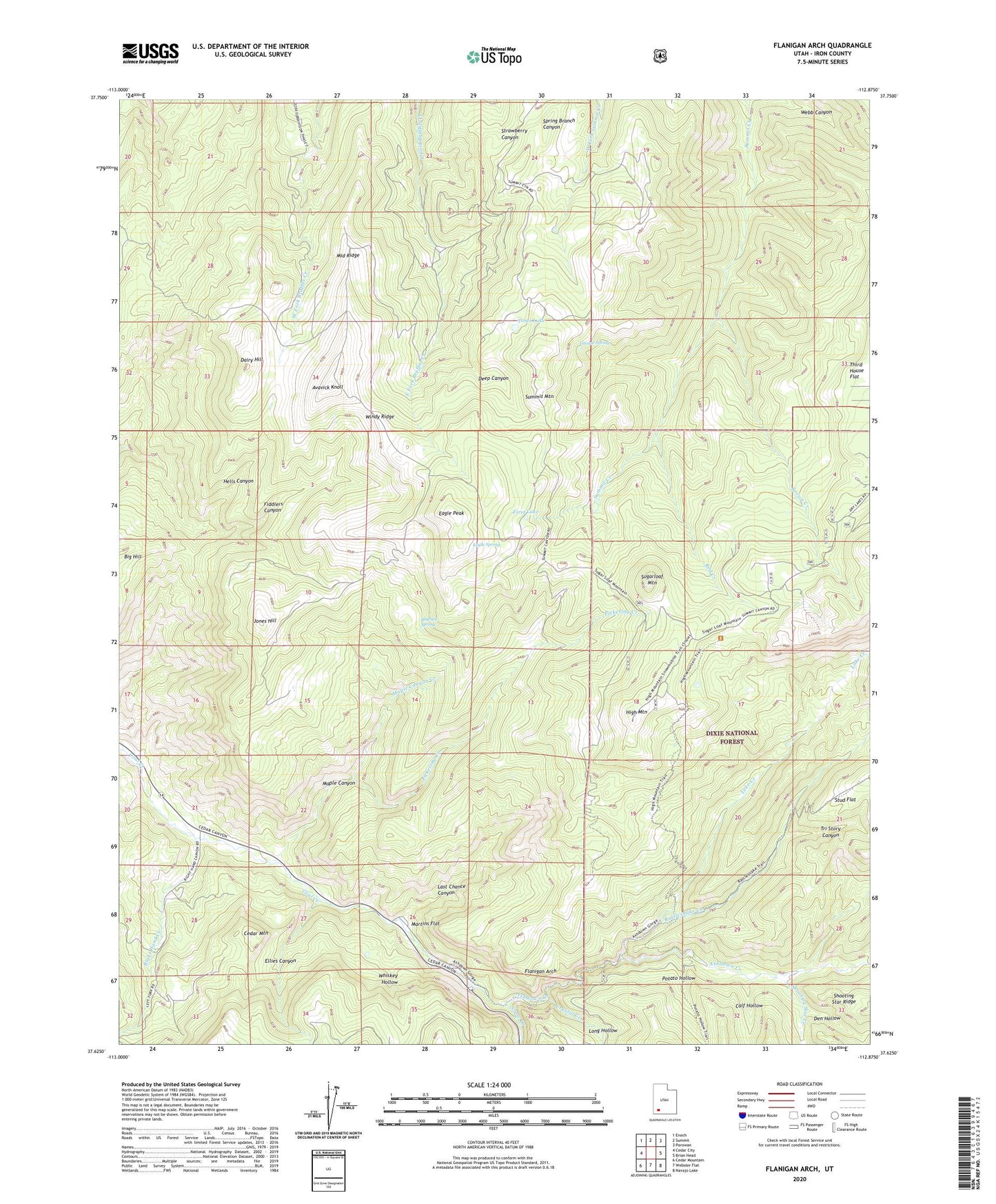
2023 topographic map quadrangle Flanigan Arch in the state of Utah. Scale: 1:24000. Based on the newly updated USGS 7.5' US Topo map series, this map is in the following counties: Iron. The map contains contour data, water features, and other items you are used to seeing on USGS maps, but also has updated roads and other features. This is the next generation of topographic maps. Printed on high-quality waterproof paper with UV fade-resistant inks.
Quads adjacent to this one:
West: Cedar City
Northwest: Enoch
North: Summit
Northeast: Parowan
East: Brian Head
Southeast: Navajo Lake
South: Webster Flat
Southwest: Cedar Mountain
This map covers the same area as the classic USGS quad with code o37112f8.
Contains the following named places: Ashdoen Gorge Wilderness, Ashdown Creek, Ashdown Gorge Wilderness, Avavick Knoll, Big Hill, Bluebell Spring, Brown Creek, Calf Hollow, Cedar Mountain, Cluff Mine, Crow Creek, Dairy Hill, Deep Canyon, Den Hollow, Eagle Peak, Eagle Spring, Ellies Canyon, First Lake, Flanigan Arch, Grouse Spring, Hells Canyon, High Mountain, Jones Hill, Lake Creek, Last Chance Canyon, Long Hollow, MacFarlane Mine, Maple Canyon, Maple Canyon Creek, Martins Flat, Middle Ridge, Pickering Creek, Potato Hollow, Rattlesnake Creek, Rattlesnake Creek Trail, Red Creek, Right Hand Creek, Shooting Star Creek, Spring Creek, Stud Flat, Sugarloaf Mountain, Summit Mountain, Third House Flat, Tinks Racetrack, Toms Lake, Tri Story Canyon, Whiskey Hollow, Windy Ridge