MyTopo
Summit Utah US Topo Map
Couldn't load pickup availability
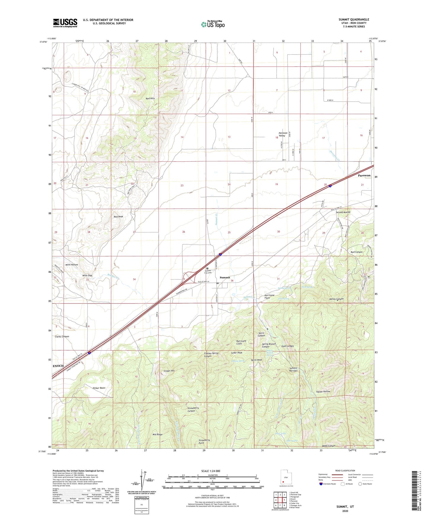
2023 topographic map quadrangle Summit in the state of Utah. Scale: 1:24000. Based on the newly updated USGS 7.5' US Topo map series, this map is in the following counties: Iron. The map contains contour data, water features, and other items you are used to seeing on USGS maps, but also has updated roads and other features. This is the next generation of topographic maps. Printed on high-quality waterproof paper with UV fade-resistant inks.
Quads adjacent to this one:
West: Enoch
Northwest: Enoch NE
North: Parowan Gap
Northeast: Paragonah
East: Parowan
Southeast: Brian Head
South: Flanigan Arch
Southwest: Cedar City
This map covers the same area as the classic USGS quad with code o37112g8.
Contains the following named places: Cedar Peak, Cheney Spring, Cheney Spring Canyon, Cinder Hill, Dalley Canyon, Deer Creek, Deer Lake, Deer Spring, East Fork Braffits Creek, Elliker Basin, First Spring, Goat Ledges, Parowan Front Wildlife Management Area, Red Canyon, Red Peak, Second Mound, Second Spring, Spirit Canyon, Spirit Peak, Spring Branch Canyon, Spring Branch Spring, Squaw Hollow, Strawberry Canyon, Strawberry Point, Summit, Summit Census Designated Place, Summit City Cemetery, Summit Creek, Summit Narrows, Summit Post Office, The Church of Jesus Christ of Latter Day Saints, Third Spring, Webb Canyon, West Fork Braffits Creek, West Fork Summit Creek, Winn Gap, ZIP Code: 84772