MyTopo
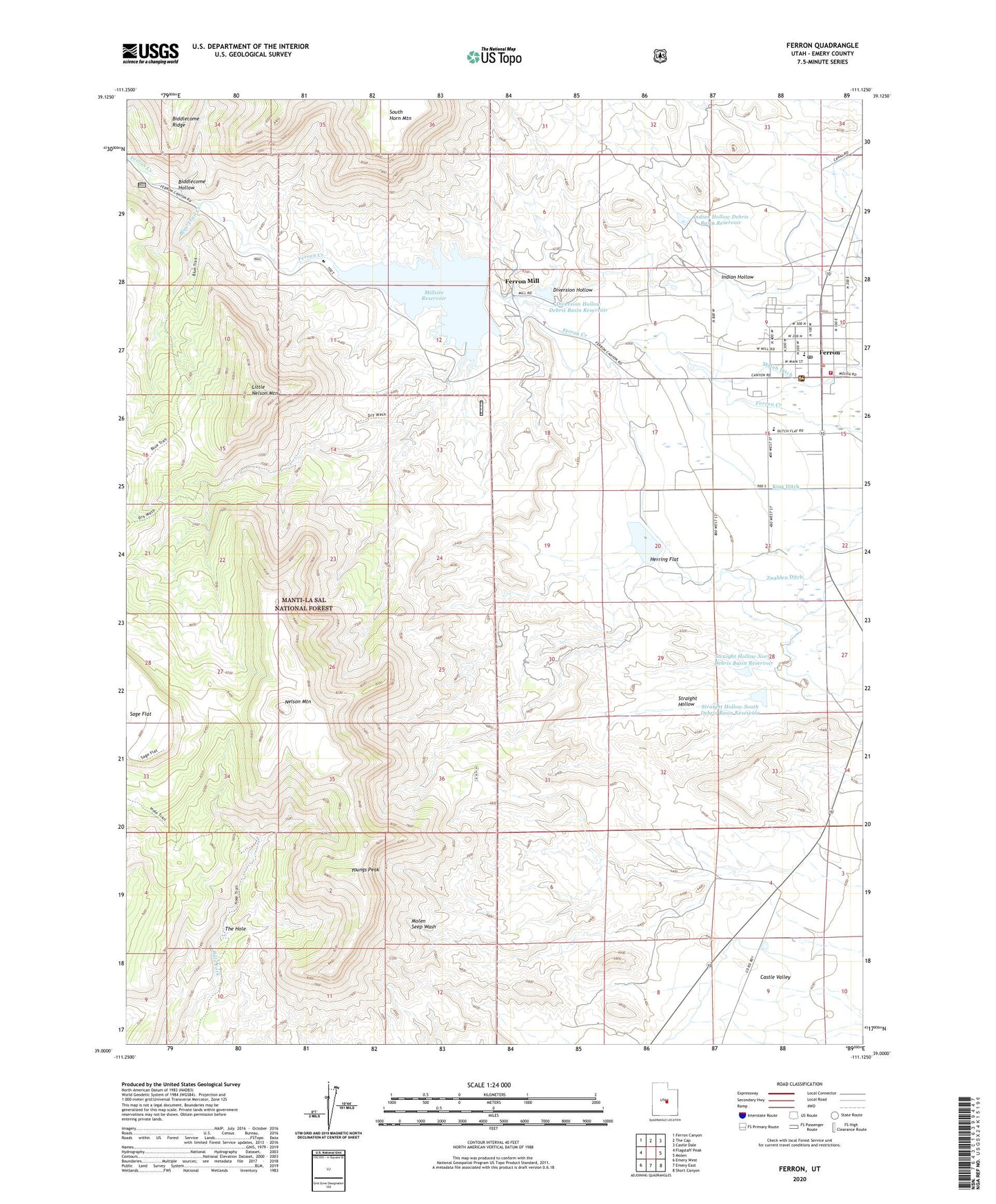
Ferron Utah US Topo Map
Couldn't load pickup availability
Also explore the Ferron Forest Service Topo of this same quad for updated USFS data
2023 topographic map quadrangle Ferron in the state of Utah. Scale: 1:24000. Based on the newly updated USGS 7.5' US Topo map series, this map is in the following counties: Emery. The map contains contour data, water features, and other items you are used to seeing on USGS maps, but also has updated roads and other features. This is the next generation of topographic maps. Printed on high-quality waterproof paper with UV fade-resistant inks.
Quads adjacent to this one:
West: Flagstaff Peak
Northwest: Ferron Canyon
North: The Cap
Northeast: Castle Dale
East: Molen
Southeast: Short Canyon
South: Emery East
Southwest: Emery West
This map covers the same area as the classic USGS quad with code o39111a2.
Contains the following named places: Biddlecome Hollow, Bills Fork, Blue Dugway, Blue Trail, Blue Trail Creek, Cattle Country Mobile Home Campground, City of Ferron, Diversion Hollow, Diversion Hollow Debris Basin Reservoir, Dry Wash, Dry Wash Trail, Emery County Ambulance - Ferron, Emery County Home, Ferron, Ferron Debris Basin Number Five Dam, Ferron Debris Basin Number Four Dam, Ferron Debris Basin Number One Dam, Ferron Debris Basin Number Three Dam, Ferron Debris Basin Number Two Dam, Ferron District Ranger Station, Ferron Elementary School, Ferron Fire Department, Ferron Mill, Ferron Post Office, First Baptist Church, Herring Flat, Hole Trail, Indian Hollow, Indian Hollow Debris Basin Reservoir, King Ditch, Little Nelson Mountain, Mill Site Campground, Millsite Dam, Millsite Golf Course, Millsite Reservoir, Millsite State Park, Nelson Mountain, Peterson Ranch, San Rafael Junior High School, South Ditch, Straight Hollow North Debris Basin Reservoir, Straight Hollow South Debris Basin Reservoir, The Church of Jesus Christ of Latter Day Saints, The Hole, Youngs Peak, Zwahlen Wash, Zwahlen Wash Debris Basin Reservoir, ZIP Code: 84523