
MyTopo
Flaming Gorge Utah US Topo Map
Couldn't load pickup availability
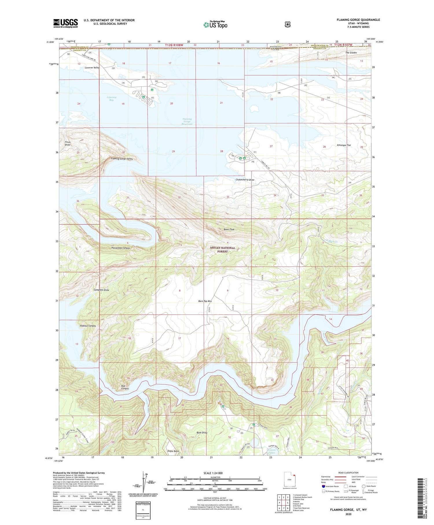
2020 topographic map quadrangle Flaming Gorge in the state of Utah. Scale: 1:24000. Based on the newly updated USGS 7.5' US Topo map series, this map is in the following counties: Daggett, Sweetwater. The map contains contour data, water features, and other items you are used to seeing on USGS maps, but also has updated roads and other features. This is the next generation of topographic maps. Printed on high-quality waterproof paper with UV fade-resistant inks.
Quads adjacent to this one:
West: Manila
Northwest: Linwood Canyon
North: Haystack Buttes South
Northeast: Minnies Gap
East: Dutch John
Southeast: Mount Lena
South: East Park Reservoir
Southwest: Elk Park
Contains the following named places: Antelope Flat Campground, Antelope Flat Development, Ashley Falls, Bare Top Mountain, Boars Tusk, Buck Draw, Campbell Draw, Canyon Rim Campground, Carter Creek, Chokecherry Draw, Daggett County, Eagle Basin, Eagle Creek, Finch Draw, Flaming Gorge, Flaming Gorge Valley, Gooseneck Boat Camp, Greens Lakes, Henrys Fork, Hideout Canyon, Hideout Eagle Basin Trail, Horseshoe Canyon, Linwood Bay, Lucerne Point Group Site, Lucerne Valley, Lucerne Valley Campground, Lucerne Valley Development, Lucerne Valley Marina, North Skull Creek, Red Canyon Lodge, Red Canyon Overlook, Red Canyon Picnic Area, Red Canyon Visitor Center, Skull Creek, Spring Creek, Trail Creek Ranch, West Fork Eagle Creek


