MyTopo
Flume Canyon Utah US Topo Map
Couldn't load pickup availability
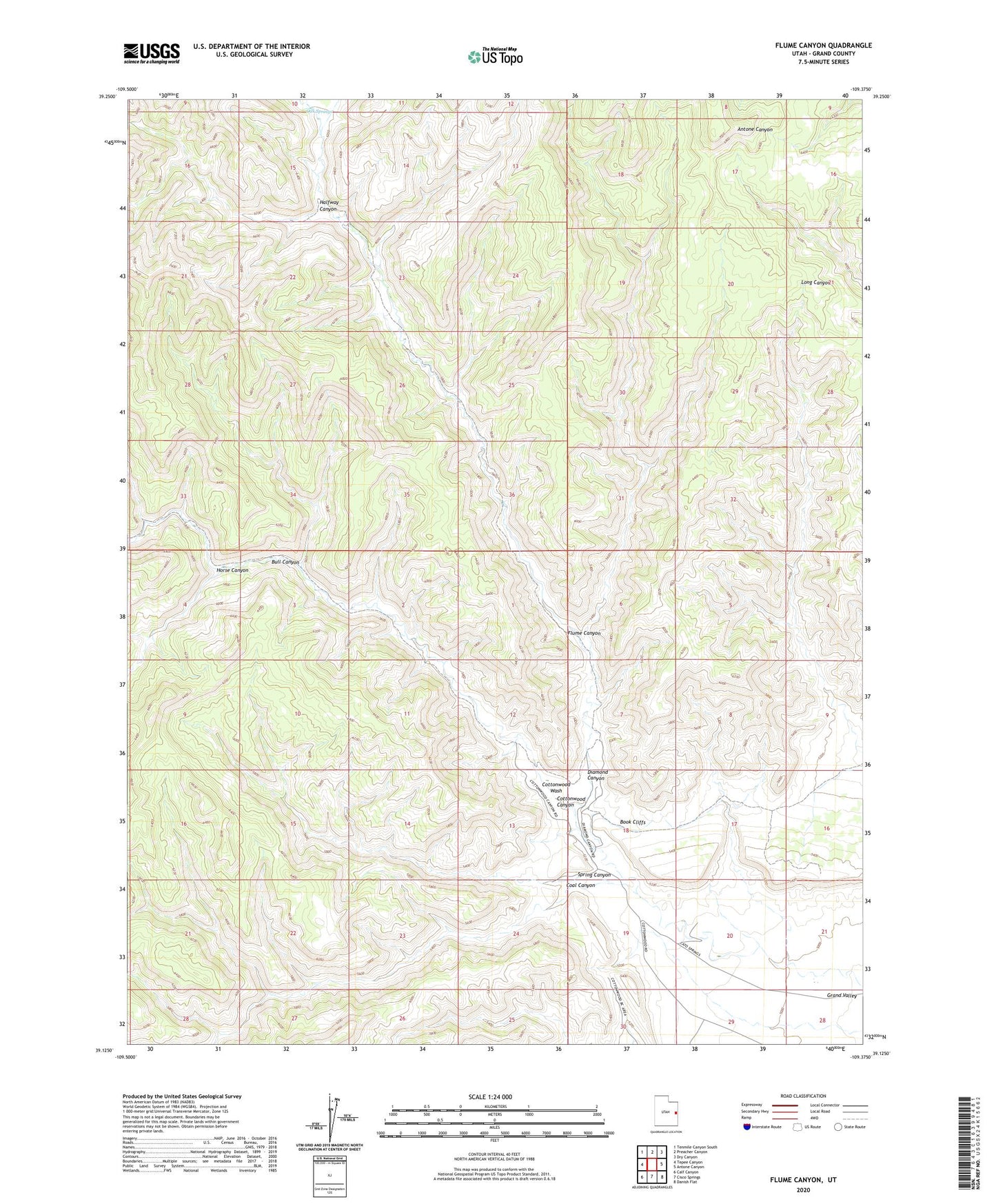
2020 topographic map quadrangle Flume Canyon in the state of Utah. Scale: 1:24000. Based on the newly updated USGS 7.5' US Topo map series, this map is in the following counties: Grand. The map contains contour data, water features, and other items you are used to seeing on USGS maps, but also has updated roads and other features. This is the next generation of topographic maps. Printed on high-quality waterproof paper with UV fade-resistant inks.
Quads adjacent to this one:
West: Tepee Canyon
Northwest: Tenmile Canyon South
North: Preacher Canyon
Northeast: Dry Canyon
East: Antone Canyon
Southeast: Danish Flat
South: Cisco Springs
Southwest: Calf Canyon
Contains the following named places: Book Cliffs Oil and Gas Field, Bull Canyon, Cisco Springs North Gas Field, Coal Canyon, Cottonwood Canyon, Diamond Canyon, Flume Canyon, Halfway Canyon, Horse Canyon, Oak Springs, Spring Canyon, ZIP Code: 84540