
MyTopo
Fort Duchesne Utah US Topo Map
Couldn't load pickup availability
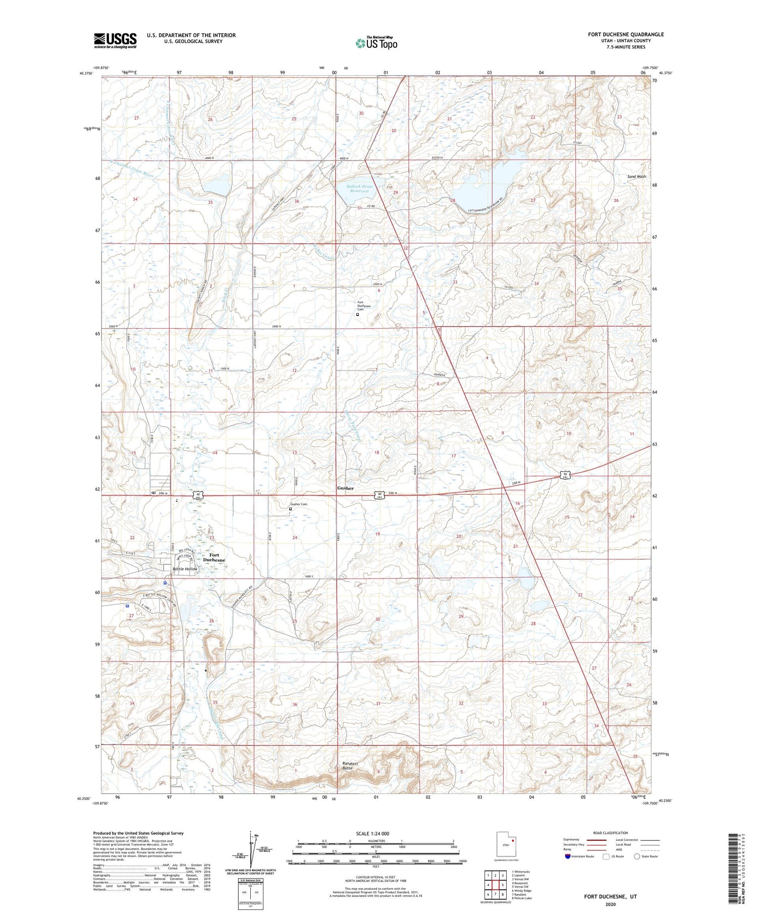
2020 topographic map quadrangle Fort Duchesne in the state of Utah. Scale: 1:24000. Based on the newly updated USGS 7.5' US Topo map series, this map is in the following counties: Uintah. The map contains contour data, water features, and other items you are used to seeing on USGS maps, but also has updated roads and other features. This is the next generation of topographic maps. Printed on high-quality waterproof paper with UV fade-resistant inks.
Quads adjacent to this one:
West: Roosevelt
Northwest: Whiterocks
North: Lapoint
Northeast: Vernal NW
East: Vernal SW
Southeast: Pelican Lake
South: Randlett
Southwest: Windy Ridge
Contains the following named places: Bottle Hollow, Bottle Hollow Resort, Bullock Draw Dam, Bullock Draw Reservoir, Deep Creek, East Channel Uinta River, Fort Duchesne, Fort Duchesne Cemetery, Fort Duchesne Police Department, Fort Duchesne Post Office, Gusher, Gusher Cemetery, Indian Agency Headquarters, Moffat Canal, North Bottle Hollow Dam, Old Fort Duchesne, Ouray Park Canal, Randlett Butte, South Bottle Hollow Dam, Thunderbird Acres Park Campground, Uintah and Ouray Indian Cemetery, United States Bureau of Indian Affairs Uintah and Ouray Agency Police Department, Ute Tribe Ambulance Service, West Channel Uinta River, ZIP Code: 84026


