MyTopo
Whiterocks Utah US Topo Map
Couldn't load pickup availability
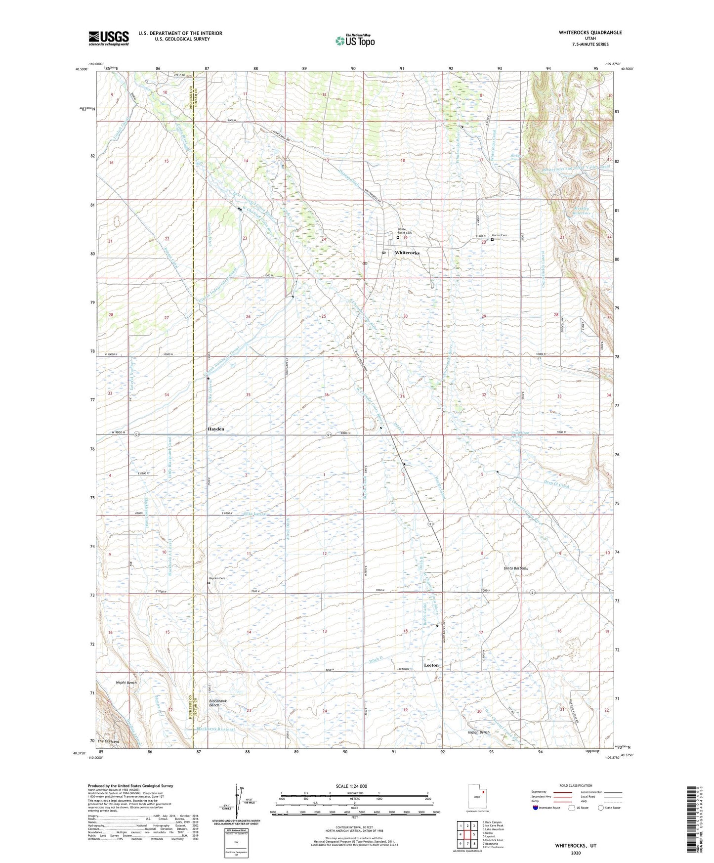
2023 topographic map quadrangle Whiterocks in the state of Utah. Scale: 1:24000. Based on the newly updated USGS 7.5' US Topo map series, this map is in the following counties: Uintah, Duchesne. The map contains contour data, water features, and other items you are used to seeing on USGS maps, but also has updated roads and other features. This is the next generation of topographic maps. Printed on high-quality waterproof paper with UV fade-resistant inks.
Quads adjacent to this one:
West: Neola
Northwest: Dark Canyon
North: Ice Cave Peak
Northeast: Lake Mountain
East: Lapoint
Southeast: Fort Duchesne
South: Roosevelt
Southwest: Hancock Cove
This map covers the same area as the classic USGS quad with code o40109d8.
Contains the following named places: Allred Ditch, Big Six Canal, Blackhawk A Lateral, Blackhawk B Lateral, Blackhawk Bench, Blackhawk Canal, Bypass Canal, Copperfields Lateral, Ditch A, Ditch B, Ditch C, Ditch D, Duncan Ditch, Farm Creek, Fort Robidoux Historical Monument, Harms Canal, Harms Cemetery, Hayden, Hayden Cemetery, Indian Sun Dance Grounds, Larsen Ditch, Leeton, Little Blackhawk Canal, Merkley Drop, Merkley Reservoir, Nephi Bench, Silka Lateral, The Church of Jesus Christ of Latter Day Saints, Uinta Bottoms, Uintah Independent Canal, Uintah Meridian, Uintah Number 1 Canal, Uriah Heap Springs, White Rocks Cemetery, Whiterocks, Whiterocks Census Designated Place, Whiterocks Fish Hatchery, Whiterocks Post Office, Whiterocks River