MyTopo
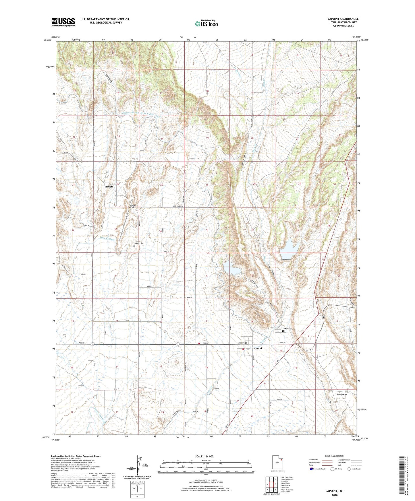
Lapoint Utah US Topo Map
Couldn't load pickup availability
2023 topographic map quadrangle Lapoint in the state of Utah. Scale: 1:24000. Based on the newly updated USGS 7.5' US Topo map series, this map is in the following counties: Uintah. The map contains contour data, water features, and other items you are used to seeing on USGS maps, but also has updated roads and other features. This is the next generation of topographic maps. Printed on high-quality waterproof paper with UV fade-resistant inks.
Quads adjacent to this one:
West: Whiterocks
Northwest: Ice Cave Peak
North: Lake Mountain
Northeast: Dry Fork
East: Vernal NW
Southeast: Vernal SW
South: Fort Duchesne
Southwest: Roosevelt
This map covers the same area as the classic USGS quad with code o40109d7.
Contains the following named places: Deep Creek Canal, Diversion Dam, Lapoint, Lapoint - Tridell Fire Department, Lapoint Cemetery, Lapoint Census Designated Place, Lapoint Elementary School, Lapoint Post Office, Little Water, Paradise Air Park, The Church of Jesus Christ of Latter Day Saints, Tridell, Tridell Cemetery, Tridell Post Office, Uintah Fire District Fire Station - Lapoint - Tridell, Whiterocks and Ouray Valley Canal, ZIP Codes: 84039, 84076