MyTopo
Windy Ridge Utah US Topo Map
Couldn't load pickup availability
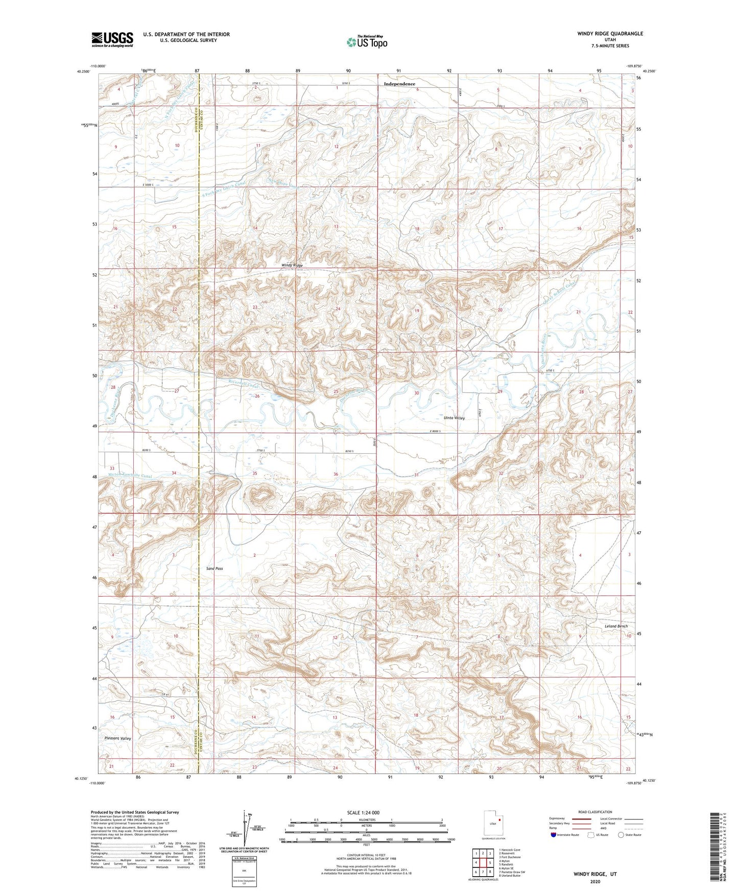
2023 topographic map quadrangle Windy Ridge in the state of Utah. Scale: 1:24000. Based on the newly updated USGS 7.5' US Topo map series, this map is in the following counties: Uintah, Duchesne. The map contains contour data, water features, and other items you are used to seeing on USGS maps, but also has updated roads and other features. This is the next generation of topographic maps. Printed on high-quality waterproof paper with UV fade-resistant inks.
Quads adjacent to this one:
West: Myton
Northwest: Hancock Cove
North: Roosevelt
Northeast: Fort Duchesne
East: Randlett
Southeast: Uteland Butte
South: Pariette Draw SW
Southwest: Myton SE
This map covers the same area as the classic USGS quad with code o40109b8.
Contains the following named places: Independence, Myton Townsite Canal, North Fork Dry Gulch Canal, Sand Pass, South Fork Dry Gulch Canal, Windy Ridge, ZIP Code: 84052