MyTopo
Pelican Lake Utah US Topo Map
Couldn't load pickup availability
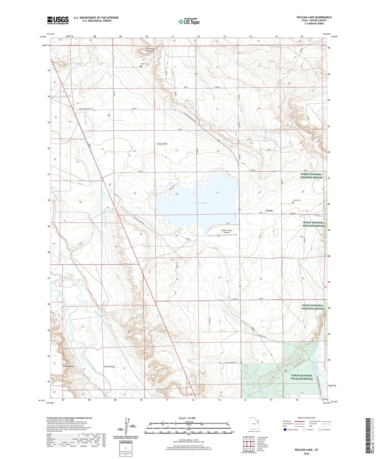
2023 topographic map quadrangle Pelican Lake in the state of Utah. Scale: 1:24000. Based on the newly updated USGS 7.5' US Topo map series, this map is in the following counties: Uintah. The map contains contour data, water features, and other items you are used to seeing on USGS maps, but also has updated roads and other features. This is the next generation of topographic maps. Printed on high-quality waterproof paper with UV fade-resistant inks.
Quads adjacent to this one:
West: Randlett
Northwest: Fort Duchesne
North: Vernal SW
Northeast: Vernal SE
East: Brennan Basin
Southeast: Ouray SE
South: Ouray
Southwest: Uteland Butte
This map covers the same area as the classic USGS quad with code o40109b6.
Contains the following named places: Avalon Cemetery, Lake Canal, Leota, Leota Cemetery, Ouray National Wildlife Refuge Fire Station, Ouray Park, Pelican Lake, Pelican Lake Airport, Pelican Lake Campground, Pelican Lake Dam, Silvestre Overlook, Uintah Fire District Fire Station - Avalon, Wissiup Ditch