MyTopo
Frisco Utah US Topo Map
Couldn't load pickup availability
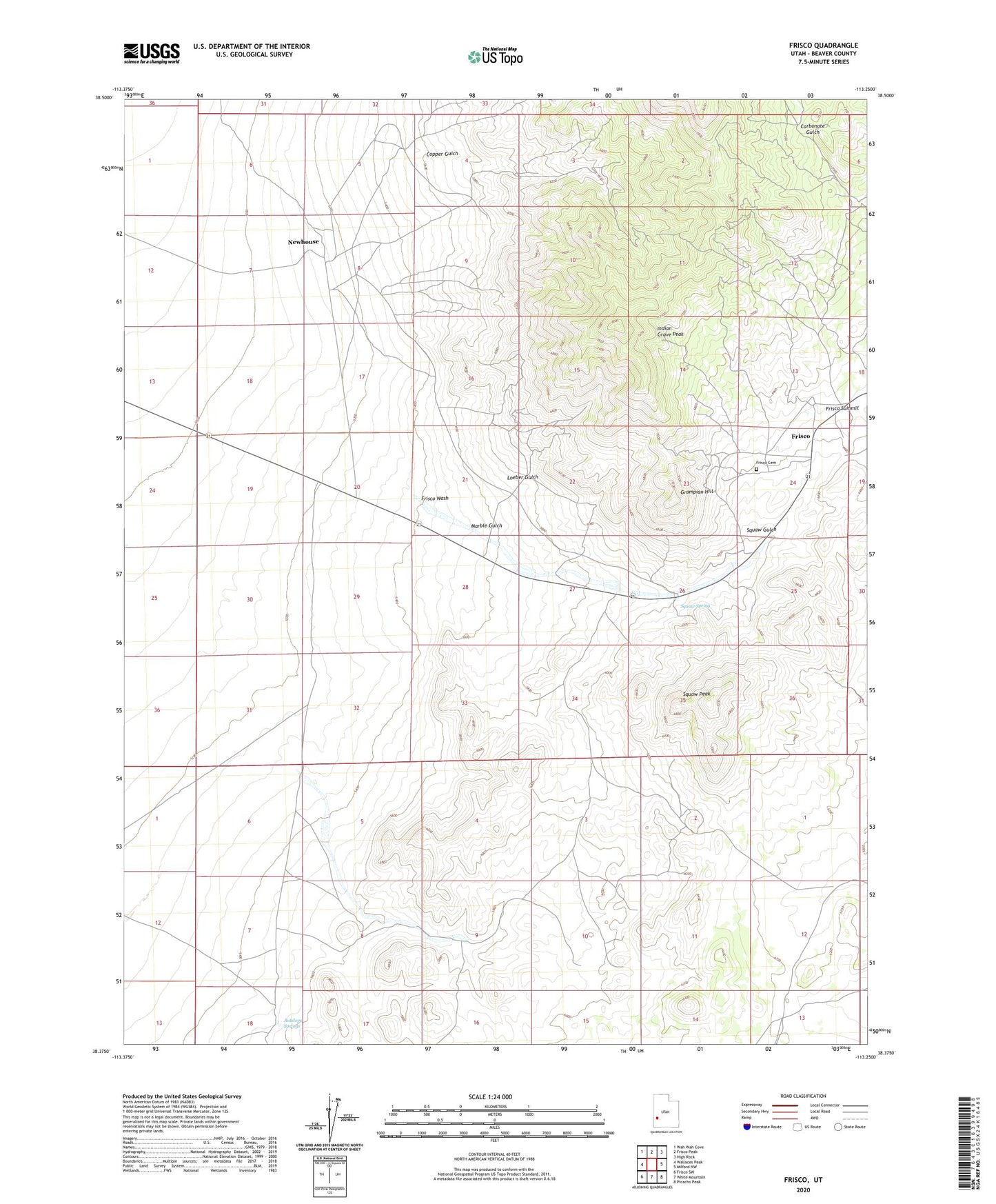
2020 topographic map quadrangle Frisco in the state of Utah. Scale: 1:24000. Based on the newly updated USGS 7.5' US Topo map series, this map is in the following counties: Beaver. The map contains contour data, water features, and other items you are used to seeing on USGS maps, but also has updated roads and other features. This is the next generation of topographic maps. Printed on high-quality waterproof paper with UV fade-resistant inks.
Quads adjacent to this one:
West: Wallaces Peak
Northwest: Wah Wah Cove
North: Frisco Peak
Northeast: High Rock
East: Milford NW
Southeast: Picacho Peak
South: White Mountain
Southwest: Frisco SW
Contains the following named places: Antelope Springs, Cactus Mine, Copper Gulch, Cupric Mine, Drum Shaft, Frisco, Frisco Cemetery, Frisco Contact Mine, Frisco Summit, Frisco Wash, Grampian Hill, Horn Silver Mine, Imperial Mine, Indian Grave Peak, Loeber Gulch, Lulu Mine, Marble Gulch, Newhouse, Newhouse Post Office, Old King David Mine, Squaw Gulch, Squaw Peak, Squaw Spring, Washington Mine