
MyTopo
Fruita Utah US Topo Map
Couldn't load pickup availability
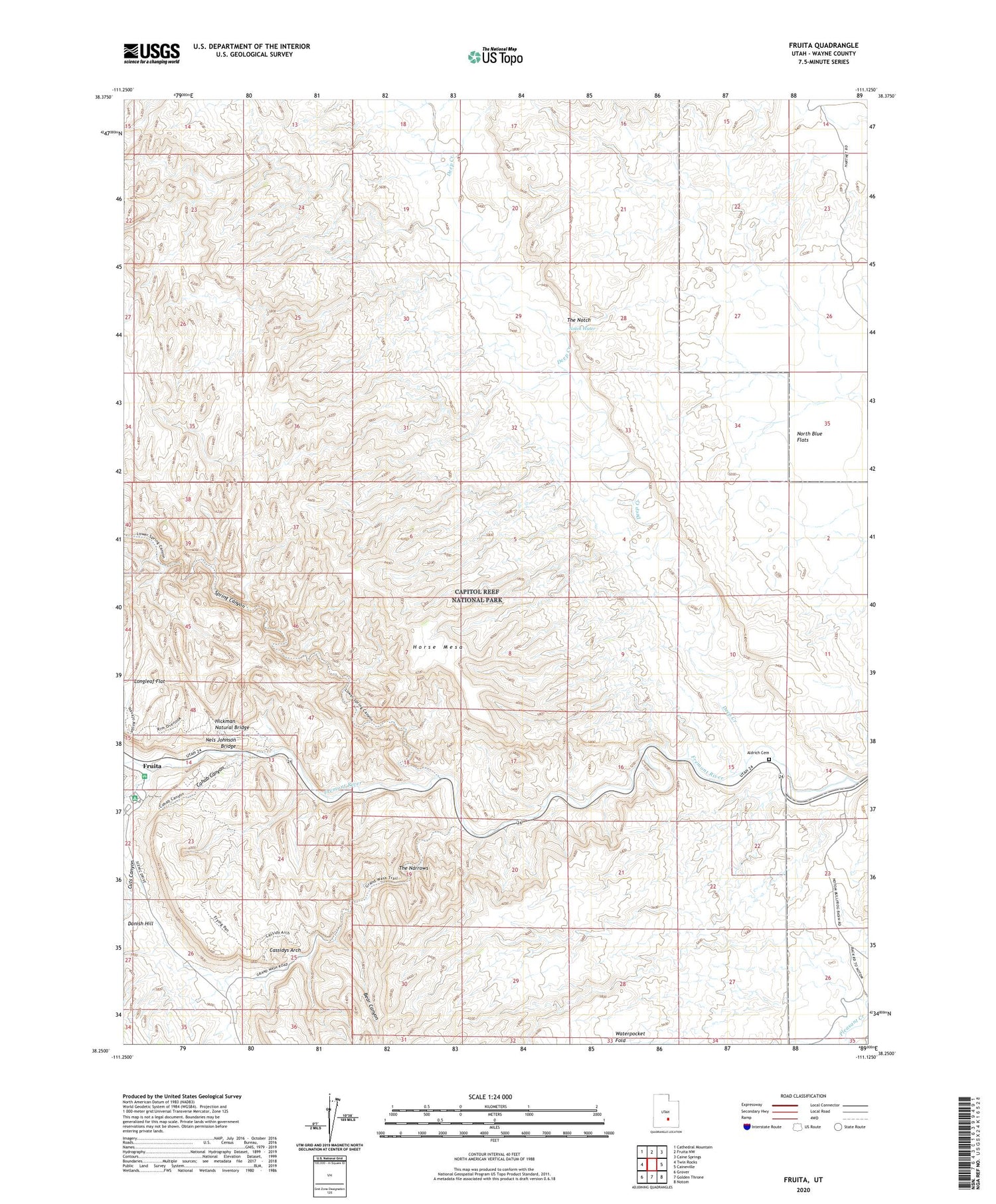
2020 topographic map quadrangle Fruita in the state of Utah. Scale: 1:24000. Based on the newly updated USGS 7.5' US Topo map series, this map is in the following counties: Wayne. The map contains contour data, water features, and other items you are used to seeing on USGS maps, but also has updated roads and other features. This is the next generation of topographic maps. Printed on high-quality waterproof paper with UV fade-resistant inks.
Quads adjacent to this one:
West: Twin Rocks
Northwest: Cathedral Mountain
North: Fruita NW
Northeast: Caine Springs
East: Caineville
Southeast: Notom
South: Golden Throne
Southwest: Grover
Contains the following named places: Aldrich Cemetery, Bear Canyon, Capitol Reef, Cassidys Arch, Cohab Canyon, Cuts Canyon, Danish Hill, Deep Creek, Dry Wash, Fruita, Fruita Campground, Grand Wash, Hickman Natural Bridge, Horse Mesa, Longleaf Flat, Nels Johnson Bridge, Notch Water, Pectols Pyramid, School House Historical Site, Spring Canyon, Sulphur Creek, The Narrows, The Notch


