MyTopo
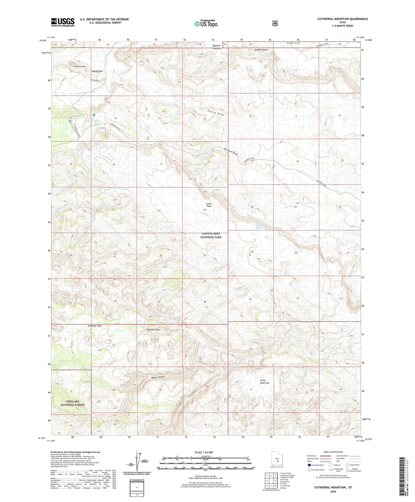
Cathedral Mountain Utah US Topo Map
Couldn't load pickup availability
Also explore the Cathedral Mountain Forest Service Topo of this same quad for updated USFS data
2023 topographic map quadrangle Cathedral Mountain in the state of Utah. Scale: 1:24000. Based on the newly updated USGS 7.5' US Topo map series, this map is in the following counties: Wayne, Emery. The map contains contour data, water features, and other items you are used to seeing on USGS maps, but also has updated roads and other features. This is the next generation of topographic maps. Printed on high-quality waterproof paper with UV fade-resistant inks.
Quads adjacent to this one:
West: Flat Top
Northwest: Geyser Peak
North: Solomons Temple
Northeast: Salvation Creek
East: Fruita NW
Southeast: Fruita
South: Twin Rocks
Southwest: Torrey
This map covers the same area as the classic USGS quad with code o38111d3.
Contains the following named places: Acklin Peak, Bullberry Creek, Cathedral Mountain, Cathedral Valley, Cathedral Valley View Area, Collins Creek, Gypsum Sinkhole, Little Sand Flat, Needle Mountain, Paradise Draw, Paradise Flats, Pierce Draw, Polk Creek, Ring Water Spring, South Desert Spring, Water Canyon