MyTopo
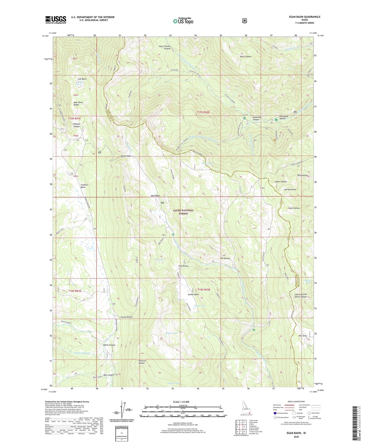
Egan Basin Idaho US Topo Map
Couldn't load pickup availability
Also explore the Egan Basin Forest Service Topo of this same quad for updated USFS data
2023 topographic map quadrangle Egan Basin in the state of Idaho. Scale: 1:24000. Based on the newly updated USGS 7.5' US Topo map series, this map is in the following counties: Franklin, Bear Lake. The map contains contour data, water features, and other items you are used to seeing on USGS maps, but also has updated roads and other features. This is the next generation of topographic maps. Printed on high-quality waterproof paper with UV fade-resistant inks.
Quads adjacent to this one:
West: Mapleton
Northwest: Mink Creek
North: Paris Peak
Northeast: Paris
East: Saint Charles
Southeast: Garden City
South: Tony Grove Creek
Southwest: Naomi Peak
This map covers the same area as the classic USGS quad with code o42111a5.
Contains the following named places: Beaver Creek Campground, Big Creek Lake, Blue Lake, Boss Canyon, Cloverleaf Campground, Corral Hollow, Cub Basin, Cub Basin Spring, Danish Pass, Egan Basin, Franklin Basin, Gibson Basin, Hidden Lake, Hodge Nibley Creek, Horse Lake, Middle Fork Saint Charles Creek, North Fork Saint Charles Creek, Pat Hollow, Porcupine Campground, Porcupine Hollow, Red Pine Spring, Red Sinks, Snowslide Canyon, South Fork Saint Charles Creek, White Canyon, Wiggler Lake