MyTopo
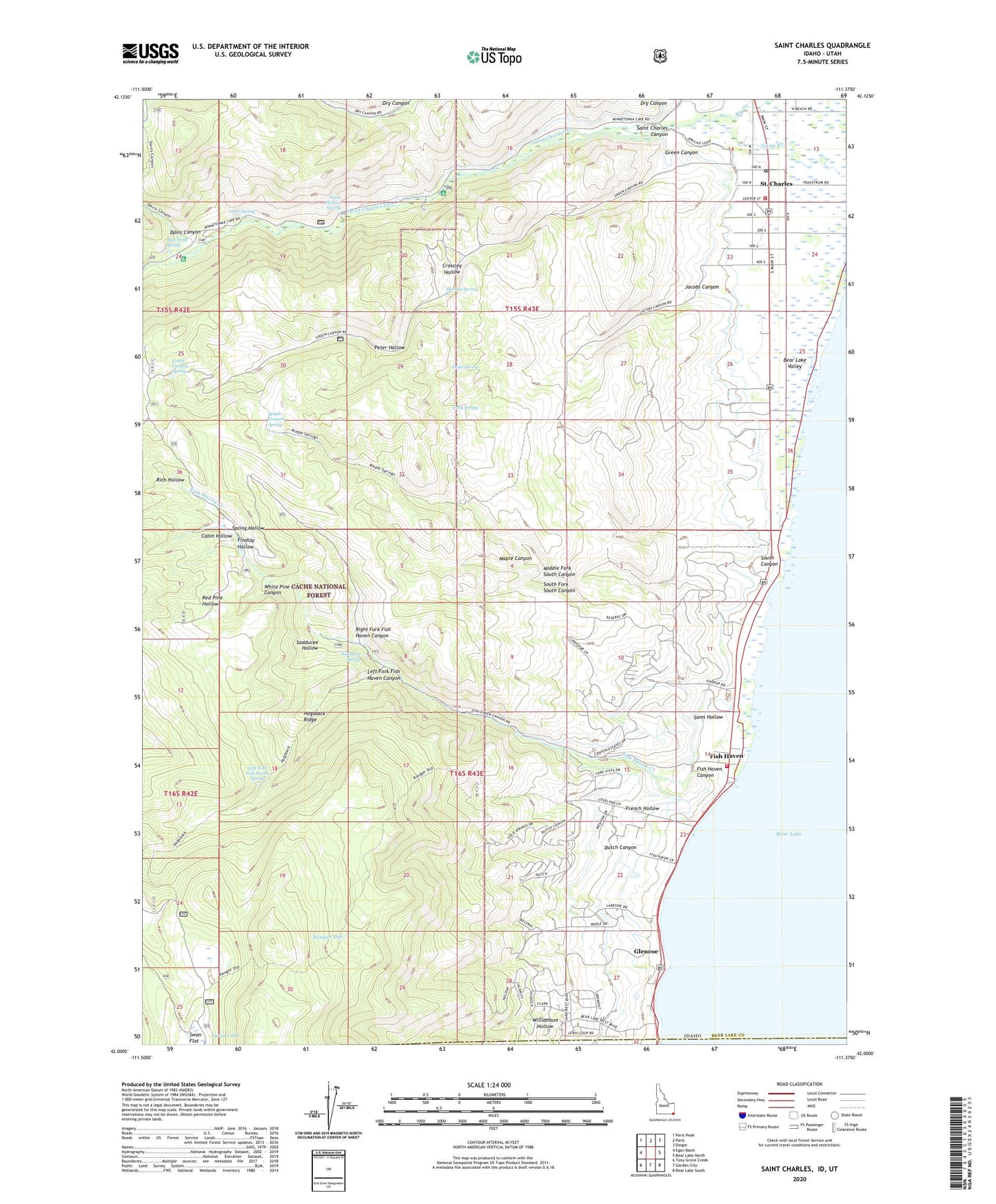
Saint Charles Idaho US Topo Map
Couldn't load pickup availability
Also explore the Saint Charles Forest Service Topo of this same quad for updated USFS data
2024 topographic map quadrangle Saint Charles in the state of Idaho. Scale: 1:24000. Based on the newly updated USGS 7.5' US Topo map series, this map is in the following counties: Bear Lake, Rich. The map contains contour data, water features, and other items you are used to seeing on USGS maps, but also has updated roads and other features. This is the next generation of topographic maps. Printed on high-quality waterproof paper with UV fade-resistant inks.
Quads adjacent to this one:
West: Egan Basin
Northwest: Paris Peak
North: Paris
Northeast: Dingle
East: Bear Lake North
Southeast: Bear Lake South
South: Garden City
Southwest: Tony Grove Creek
Contains the following named places: Bear Lake Valley, Bear Lake Volunteer Fire Protection District Station 8, Bear Lake Volunteer Fire Protection District Station 9, Blackstone Mine, Blue Pond Spring, Cabin Hollow, City of Saint Charles, Coby Spring, Crossley Hollow, Davis Canyon, Davis Canyon Recreation Site, Dry Canyon, Dune Spring, Dutch Canyon, Findlay Hollow, Fish Haven, Fish Haven Canyon, Fish Haven Cemetery, Fish Haven Creek, French Hollow, Glencoe, Green Canyon, Green Canyon Spring, Hogsback Ridge, Jacobs Canyon, Left Fork Fish Haven Canyon, Left Fork Fish Haven Spring, Little Spring, Maple Canyon, Maple Canyon Spring, Middle Fork South Canyon, Peter Hollow, Ranger Dip, Red Pine Hollow, Rich Hollow, Right Fork Fish Haven Canyon, Sadducee Hollow, Sadducee Spring, Saint Charles, Saint Charles Campground, Saint Charles Canyon, Saint Charles Cemetery, Saint Charles Creek, Saint Charles Post Office, Saint Charles Spring, Sams Hollow, Sherma Spring, South Canyon, South Fork South Canyon, Spring Hollow, Swan Lake, White Pine Canyon, Williamson Hollow, ZIP Code: 83287