MyTopo
Asay Bench Utah US Topo Map
Couldn't load pickup availability
Also explore the Asay Bench Forest Service Topo of this same quad for updated USFS data
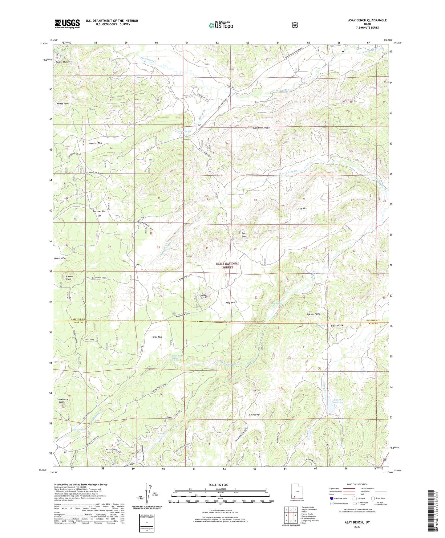
2023 topographic map quadrangle Asay Bench in the state of Utah. Scale: 1:24000. Based on the newly updated USGS 7.5' US Topo map series, this map is in the following counties: Garfield, Kane. The map contains contour data, water features, and other items you are used to seeing on USGS maps, but also has updated roads and other features. This is the next generation of topographic maps. Printed on high-quality waterproof paper with UV fade-resistant inks.
Quads adjacent to this one:
West: Henrie Knolls
Northwest: Panguitch Lake
North: Haycock Mountain
Northeast: Hatch
East: George Mountain
Southeast: Alton
South: Long Valley Junction
Southwest: Strawberry Point
This map covers the same area as the classic USGS quad with code o37112e5.
Contains the following named places: Asay Bench, Asay Knoll, Asay Spring, Black Rock Spring, Bowers Knoll, Buck Knoll, Burrows Flat, Castle Creek Dam, Castle Creek Reservoir, Castle Rock, Cold Spring, Cub Spring, Houston Flat, Ikes Valley, Little Mountain, Mammoth Ridge, McDonald Lake, McDonald Lake Dam, Sawyer Point, Spring Hollow, Strawberry Creek, Swains Creek, Uinta Flat, White Face, Wilson Creek, Wilson Spring