MyTopo
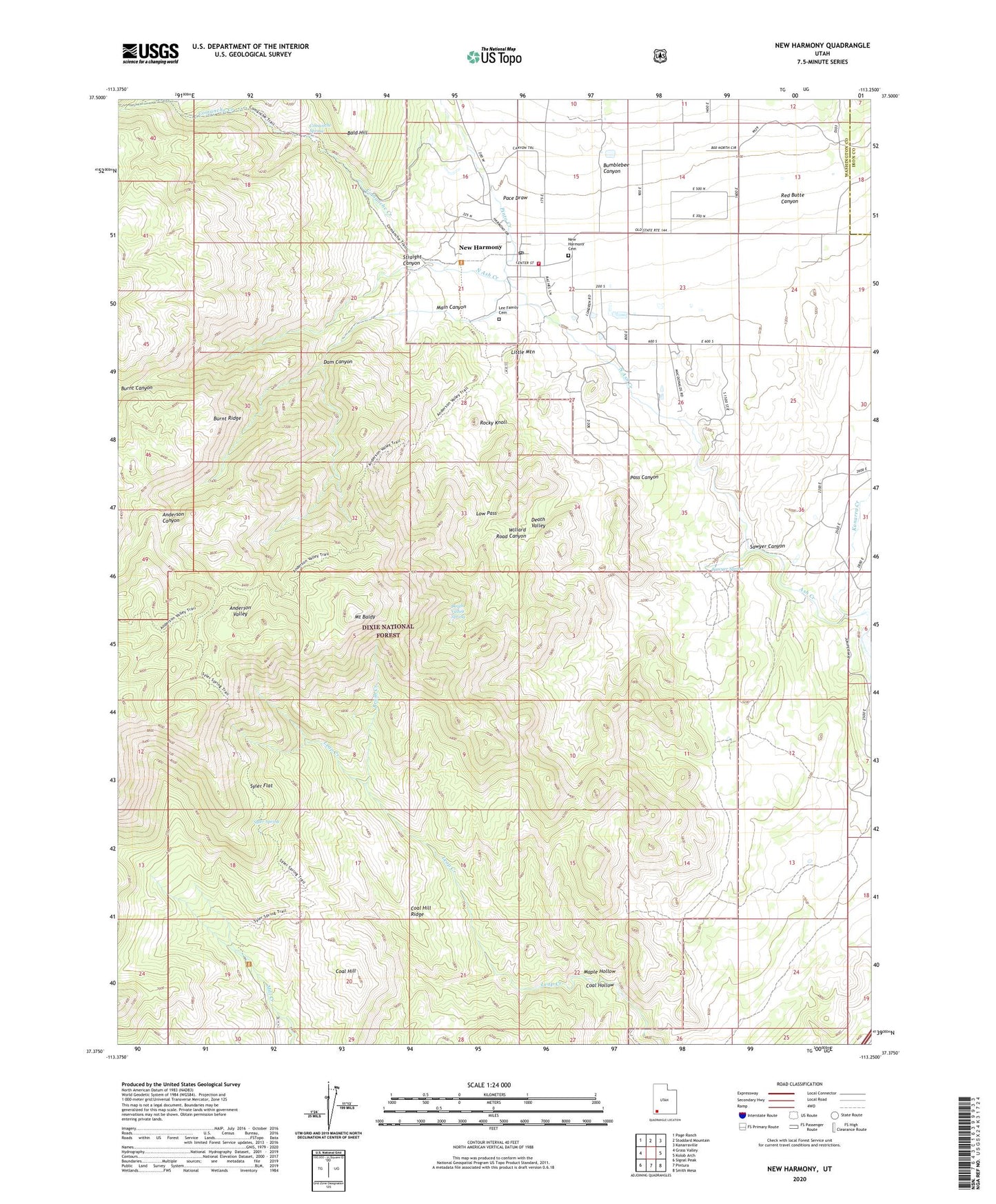
New Harmony Utah US Topo Map
Couldn't load pickup availability
Also explore the New Harmony Forest Service Topo of this same quad for updated USFS data
2023 topographic map quadrangle New Harmony in the state of Utah. Scale: 1:24000. Based on the newly updated USGS 7.5' US Topo map series, this map is in the following counties: Washington, Iron. The map contains contour data, water features, and other items you are used to seeing on USGS maps, but also has updated roads and other features. This is the next generation of topographic maps. Printed on high-quality waterproof paper with UV fade-resistant inks.
Quads adjacent to this one:
West: Grass Valley
Northwest: Page Ranch
North: Stoddard Mountain
Northeast: Kanarraville
East: Kolob Arch
Southeast: Smith Mesa
South: Pintura
Southwest: Signal Peak
This map covers the same area as the classic USGS quad with code o37113d3.
Contains the following named places: Anderson Canyon, Anderson Valley, Anderson Valley Trail, Browse Area Guard Station, Brush Creek, Bumblebee Canyon, Burnt Canyon, Burnt Ridge, Coal Hill, Coal Hill Ridge, Coal Hollow, Comanche Creek, Comanche Spring, Comanche Trail, Dam Canyon, Death Valley, Death Valley Spring, Death Valley Wash, Dry Lake, Harmony Valley Fire District, Kanarra Creek, Lee Family Cemetery, Leep Creek Trail, Little Mountain, Low Pass, Main Canyon, Maple Hollow, Mount Baldy, New Harmony, New Harmony Cemetery, New Harmony Post Office, New Harmony Trailhead, North Ash Creek, Pace Draw, Pinto Creek, Red Butte Canyon, Rocky Knoll, Sawyer Canyon, Sawyer Spring, Straight Canyon, Syler Flat, Syler Spring, The Church of Jesus Christ of Latter Day Saints, Town of New Harmony, Willard Road Canyon, ZIP Code: 84757