MyTopo
Greenville Bench Utah US Topo Map
Couldn't load pickup availability
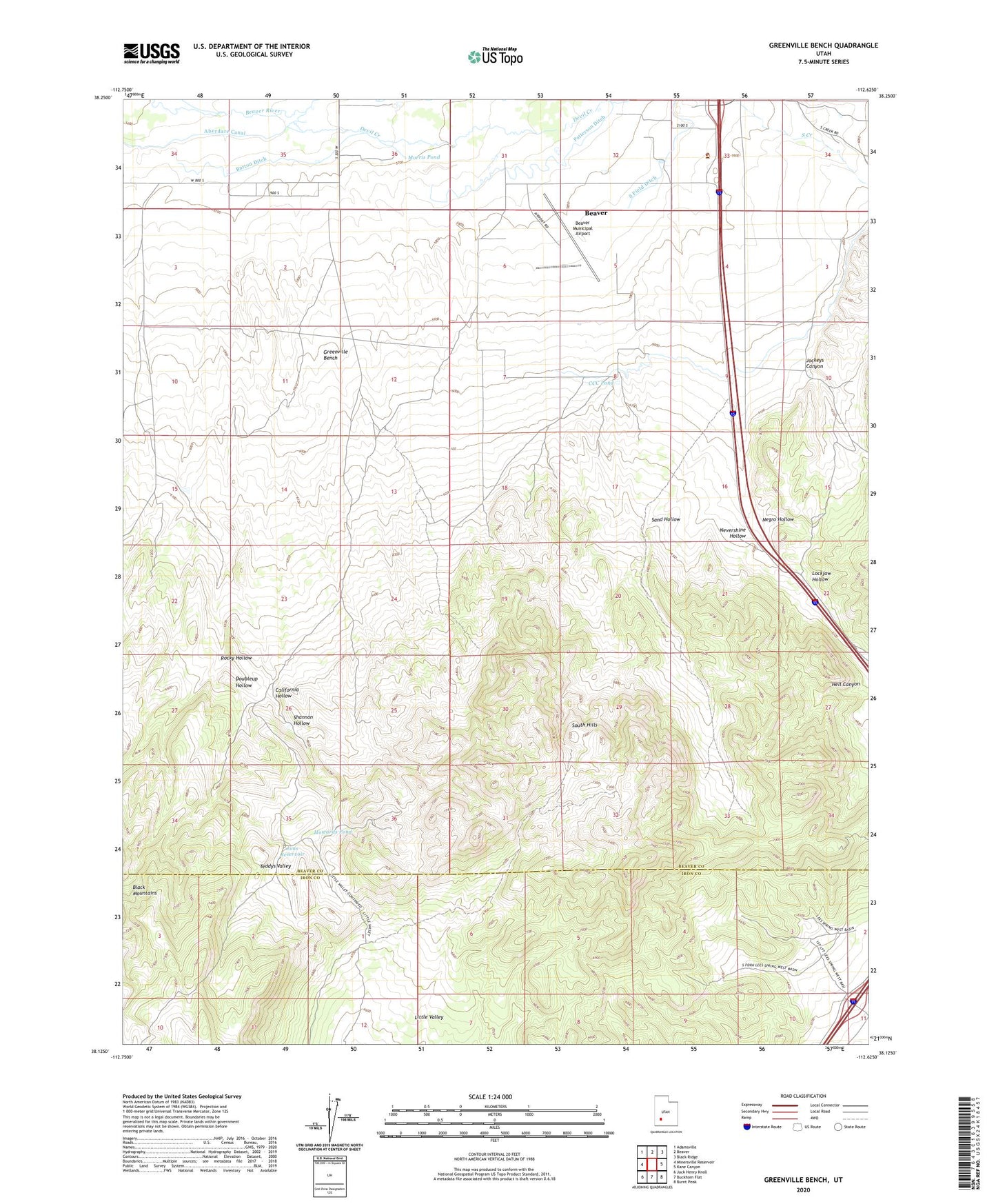
2020 topographic map quadrangle Greenville Bench in the state of Utah. Scale: 1:24000. Based on the newly updated USGS 7.5' US Topo map series, this map is in the following counties: Beaver, Iron. The map contains contour data, water features, and other items you are used to seeing on USGS maps, but also has updated roads and other features. This is the next generation of topographic maps. Printed on high-quality waterproof paper with UV fade-resistant inks.
Quads adjacent to this one:
West: Minersville Reservoir
Northwest: Adamsville
North: Beaver
Northeast: Black Ridge
East: Kane Canyon
Southeast: Burnt Peak
South: Buckhorn Flat
Southwest: Jack Henry Knoll
Contains the following named places: Aberdare Canal, Barton Ditch, Beaver County Sheriff's Office Beaver, Beaver Municipal Airport, California Hollow, CCC Pond, Devil Creek, Doubleup Hollow, Greenville Bench, Hell Canyon, Howards Pond, Jims Reservoir, Jockeys Canyon, Lockjaw Hollow, Morris Pond, Negro Hollow, Nevershine Hollow, Rattlesnake Trail, Rocky Hollow, Sand Hollow, Shannon Hollow, South Hills, Teddys Valley, Utah Highway Patrol Section 11 Beaver Office