MyTopo
Burnt Peak Utah US Topo Map
Couldn't load pickup availability
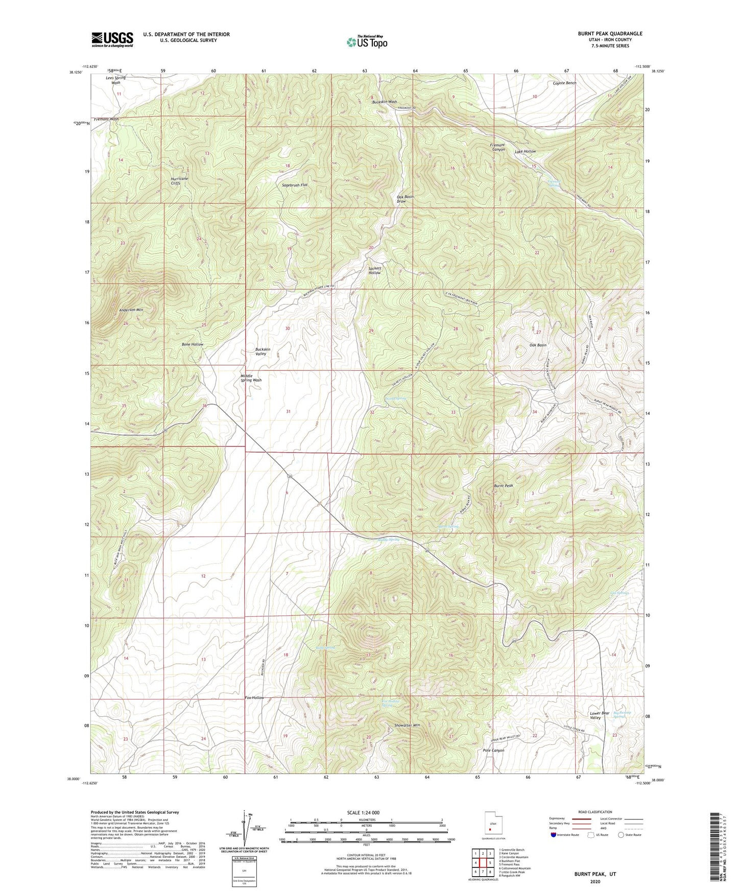
2023 topographic map quadrangle Burnt Peak in the state of Utah. Scale: 1:24000. Based on the newly updated USGS 7.5' US Topo map series, this map is in the following counties: Iron. The map contains contour data, water features, and other items you are used to seeing on USGS maps, but also has updated roads and other features. This is the next generation of topographic maps. Printed on high-quality waterproof paper with UV fade-resistant inks.
Quads adjacent to this one:
West: Buckhorn Flat
Northwest: Greenville Bench
North: Kane Canyon
Northeast: Circleville Mountain
East: Fremont Pass
Southeast: Panguitch NW
South: Little Creek Peak
Southwest: Cottonwood Mountain
This map covers the same area as the classic USGS quad with code o38112a5.
Contains the following named places: Anderson Mountain, Big Swamp Springs, Buckskin Valley, Buckskin Wash, Burnt Peak, Burnt Spring, Cox Springs, Fox Hollow, Fox Hollow Spring, Fremont Spring, Lake Hollow, Middle Spring, Middle Spring Wash, North Spring, Oak Basin, Oak Basin Draw, Pole Canyon, Robb Spring, Sackett Hollow, Sagebrush Flat, Showalter Mountain