MyTopo
Kane Canyon Utah US Topo Map
Couldn't load pickup availability
Also explore the Kane Canyon Forest Service Topo of this same quad for updated USFS data
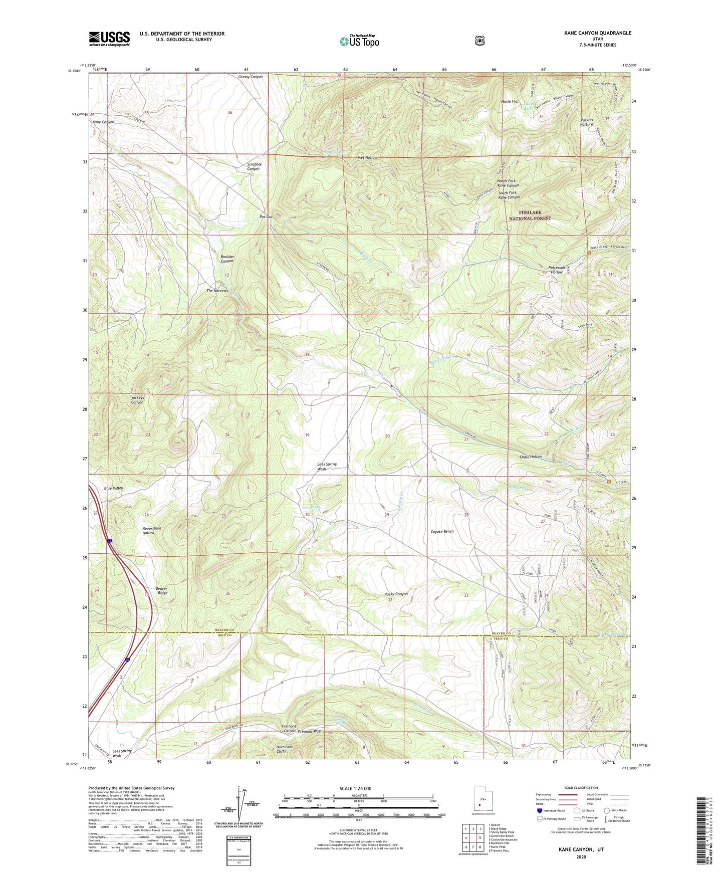
2023 topographic map quadrangle Kane Canyon in the state of Utah. Scale: 1:24000. Based on the newly updated USGS 7.5' US Topo map series, this map is in the following counties: Beaver, Iron. The map contains contour data, water features, and other items you are used to seeing on USGS maps, but also has updated roads and other features. This is the next generation of topographic maps. Printed on high-quality waterproof paper with UV fade-resistant inks.
Quads adjacent to this one:
West: Greenville Bench
Northwest: Beaver
North: Black Ridge
Northeast: Shelly Baldy Peak
East: Circleville Mountain
Southeast: Fremont Pass
South: Burnt Peak
Southwest: Buckhorn Flat
This map covers the same area as the classic USGS quad with code o38112b5.
Contains the following named places: Beaver Ridge, Big Twist Creek, Birch Creek, Blue Valley, Boulder Canyon, Chalk Creek, Chalk Hollow, Copes Dugway, Coxs Ranch, Coyote Bench, Coyote Creek, Fremont Canyon, Horse Flat, Kane Canyon, Kane Spring, Lees Spring, Mud Lake, North Fork Kane Canyon, Patterson Hollow, Porkies Pasture, Pot Gut, Rocky Canyon, Rocky Creek, Sand Cliff Spring, Scrabble Canyon, South Fork Kane Canyon, The Narrows, Wet Hollow, Wide Mouth Wash