MyTopo
Beaver Utah US Topo Map
Couldn't load pickup availability
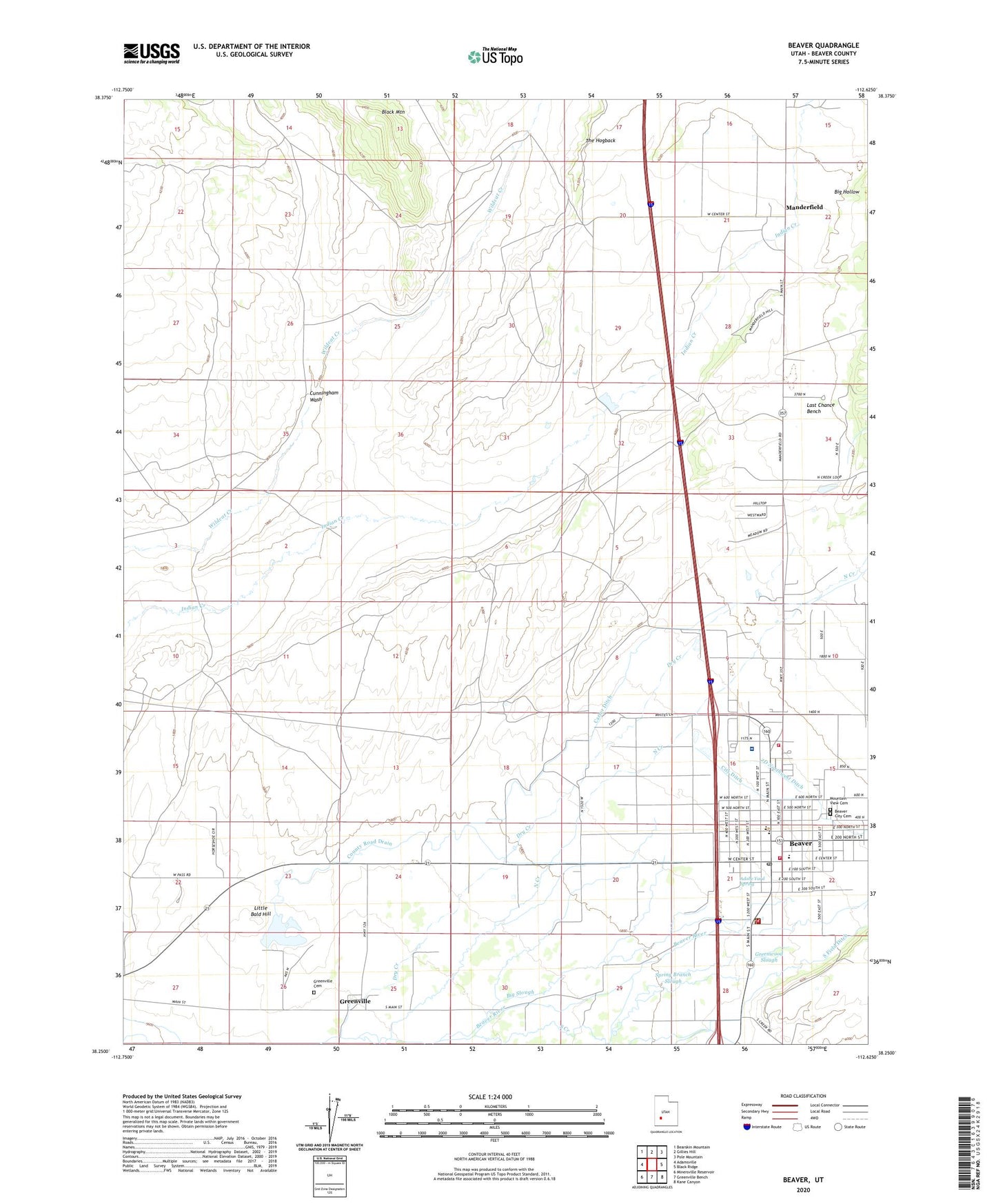
2023 topographic map quadrangle Beaver in the state of Utah. Scale: 1:24000. Based on the newly updated USGS 7.5' US Topo map series, this map is in the following counties: Beaver. The map contains contour data, water features, and other items you are used to seeing on USGS maps, but also has updated roads and other features. This is the next generation of topographic maps. Printed on high-quality waterproof paper with UV fade-resistant inks.
Quads adjacent to this one:
West: Adamsville
Northwest: Bearskin Mountain
North: Gillies Hill
Northeast: Pole Mountain
East: Black Ridge
Southeast: Kane Canyon
South: Greenville Bench
Southwest: Minersville Reservoir
This map covers the same area as the classic USGS quad with code o38112c6.
Contains the following named places: 2D Northwest Ditch, 84713, Adobe Yard Spring, Assembly of God Church, Beaver, Beaver City Cemetery, Beaver County Ambulance - Beaver, Beaver County Fire District - Beaver, Beaver County Fire District 1, Beaver Fish Hatchery, Beaver High School, Beaver Post Office, Beaver Valley Hospital, Belknap Elementary School, Belknap School, Big Hollow, Big Slough, Black Mountain, Bullberry Slough, Carter Ditch, City Ditch, City of Beaver, County Road Drain, Cunningham Wash, Delano Trailer Park, Dry Creek, First Baptist Church, Greenville, Greenville Cemetery, Greenwood Slough, Jackson County Hill, KBBD-FM (Beaver), Little Bald Hill, Manderfield, Milford Police Department Beaver, Mountain View Cemetery, North Creek, Patterson Ditch, Robinson-Tanner Dam, Robinson-Tanner Reservoir, South Creek, South Field Ditch, Spring Branch Slough, The Church of Jesus Christ of Latter Day Saints, The Hogback, United States Forest Service Fire Station Beaver Ranger District